Panther Falls and Falls Creek Falls (and Cave)

For my weekly outdoor adventure I decided to drag Dave along. For one thing, I hadn’t forced him out into the woods lately, and I thought it would be good for him. For another thing, it was a LONG drive out to the woods, and I didn’t want to be alone if I broke the Miata.

So we headed down Highway 14 to White Salmon, and headed north into the Gifford Pinchot National Forest. We had a guidebook, ‘Curious Gorge’, but in retrospect next time I’ll bring some accurate maps. This wasn’t like driving the old highway to Multnomah Falls. Forest roads are winding and poorly marked, and I was a bit worried we were going to get lost more than once! And it’s not like someone is going to come along and help you find your way, there’s not a lot of people out there in the middle of the week!

First stop: Panther Creek Falls.

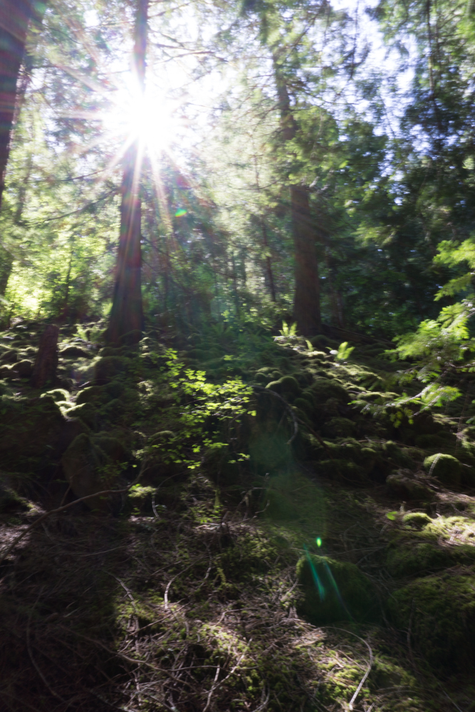
I was told this is the most spectacular waterfall you’ve never heard of. There isn’t even really a trailhead, just a wide spot of rutted dirt to park alongside the road. Then you walk back along the road about 50 ft and there’s an arrow hand-spray painted on the road that says ‘falls’ – we almost missed it. Follow the little path there into the bushes, and suddenly you are walking on a lovely path through tall trees.

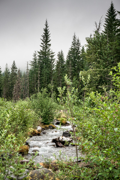
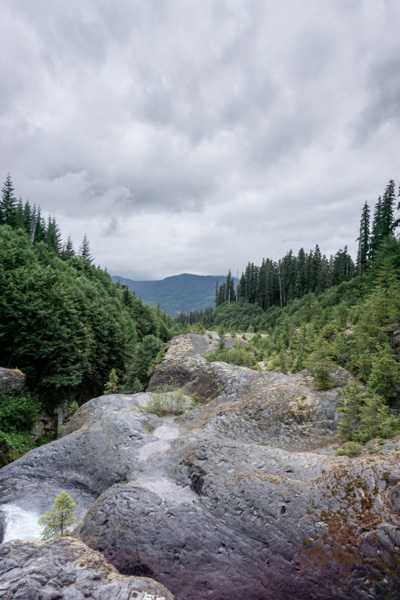
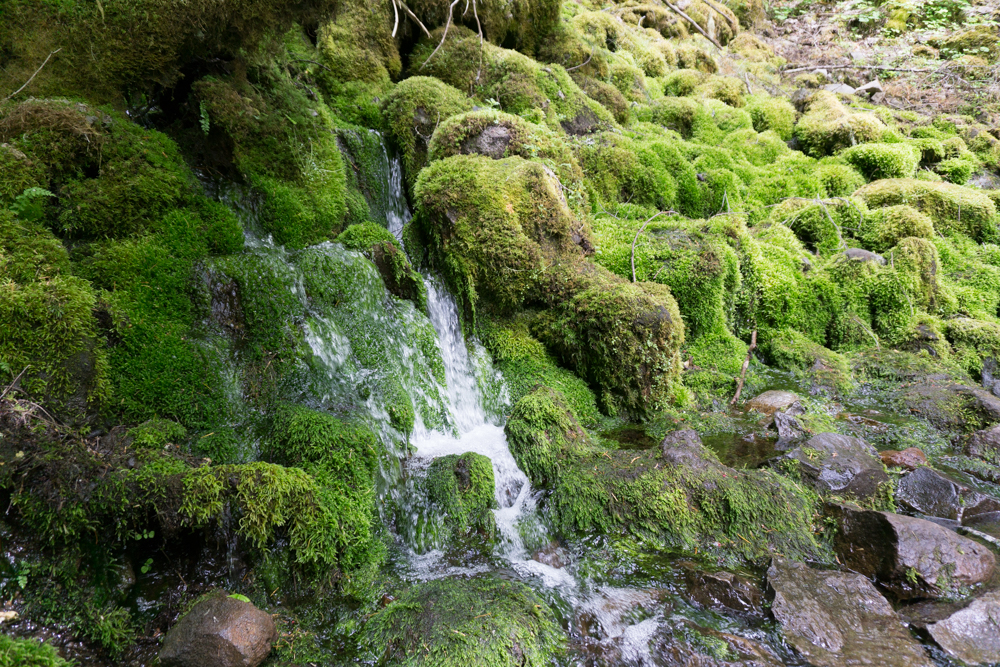
The path goes down to follow this stream a short distance, protected by a fence, and then to a viewing platform for this:

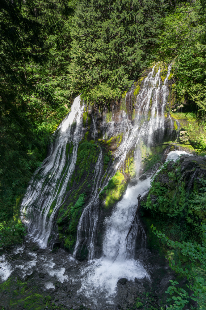
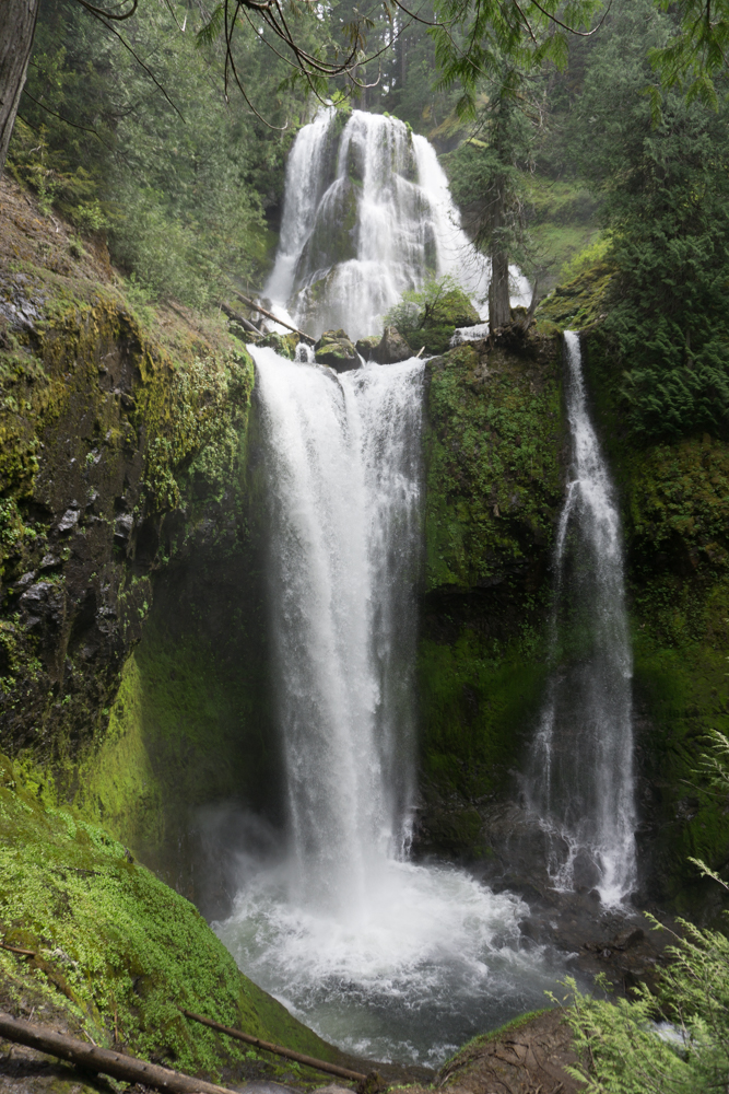
 It’s difficult to capture how big this is! It’s two streams flowing down this huge wall of rock.

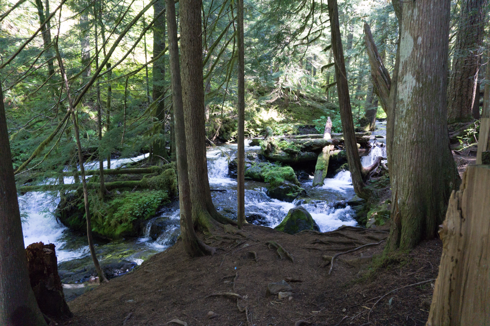
 The streams that tumble down to the waterfall are pretty impressive on their own.

So that was a very short walk to a very spectacular waterfall. People told me if it wasn’t located deep in the woods, everyone would be flocking to it. I agree!

 Next stop – Falls Creek Cave.

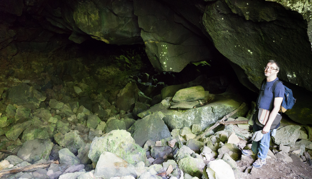
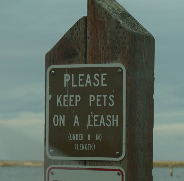
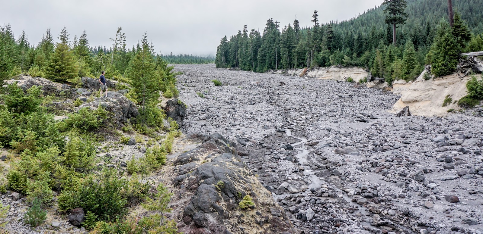
We didn’t do much at Falls Creek Cave except look at it and change our minds about going any further. I think I would do this if I came with more people, but with just the two of us, if someone got hurt, it would be bad. We decided to hold off on this adventure.

Next stop: Falls Creek Falls

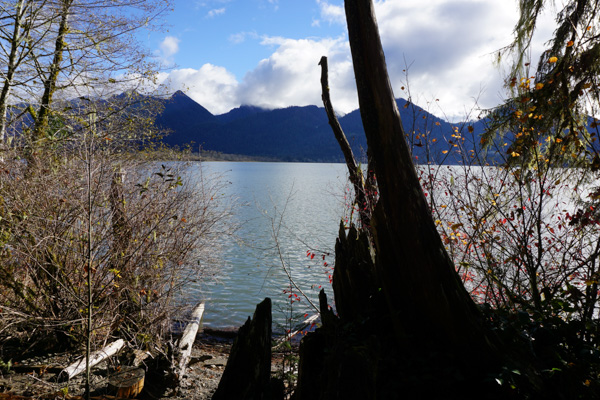
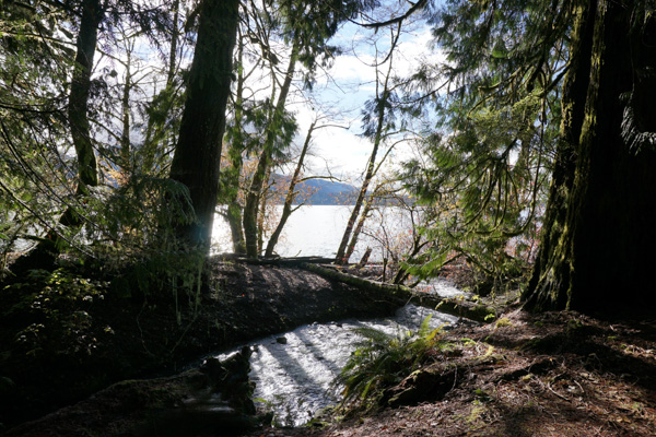
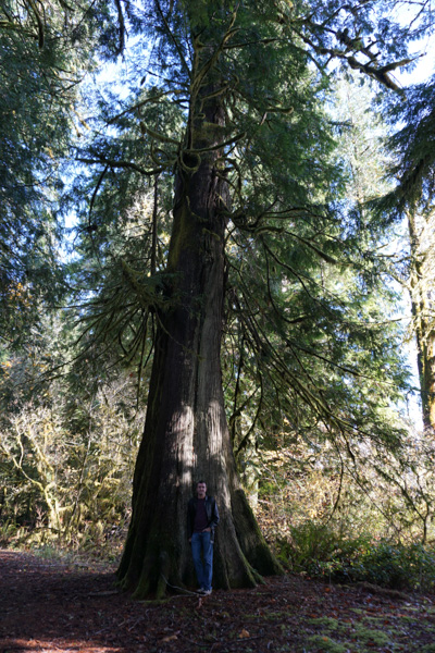
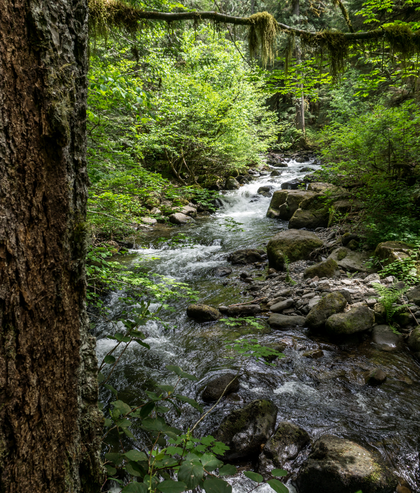
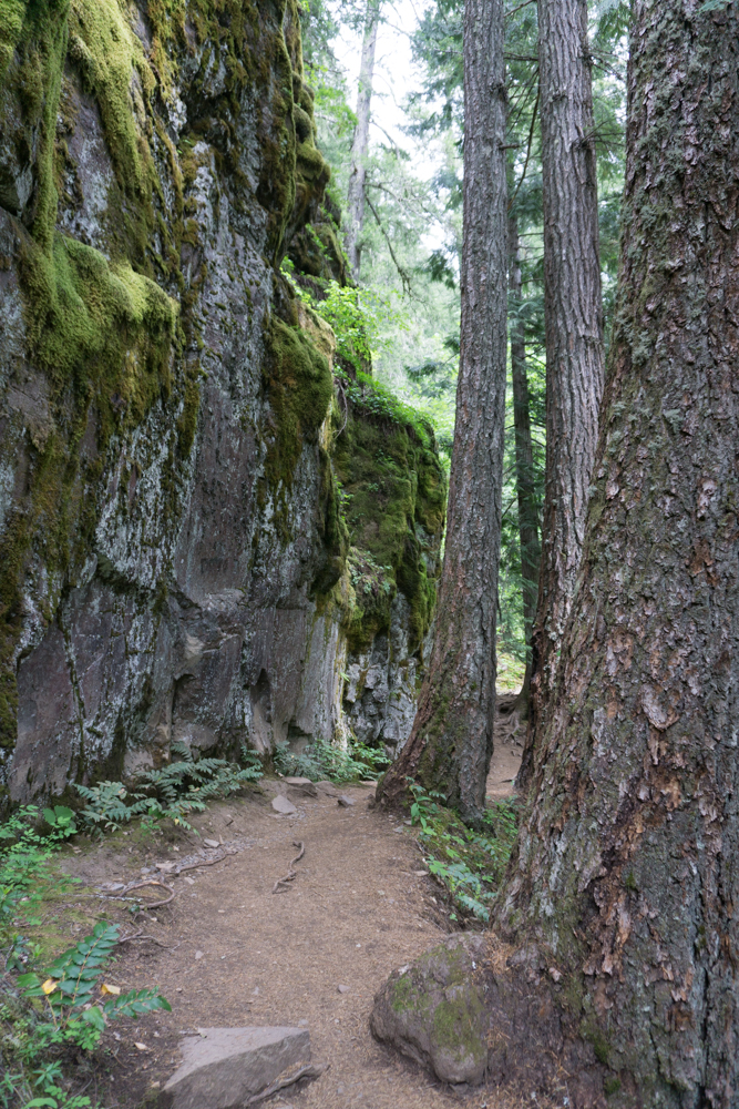
So, again, people told me this is the best waterfall in the Gorge (though it’s quite a ways from the Gorge itself. They assured me it was worth it. It’s a two mile hike in through a lovely forest along a river for much of the hike.

One neat feature, again – hard to capture in photos, was this section where you cross over a little stream coming down the hill, and the rocky area the water is coming out of is all covered in beautiful moss. It was really other-worldly.
The trail continued along past this neat rock wall all covered in moss and ferns
Finally we heard the falls, and looking up, way up, we caught sight of it – the upper falls. Seeing photos of it did not prepare me for how HUGE it was, and the spectacular roar of the water, and the rush of wind coming off of it. It was amazing!

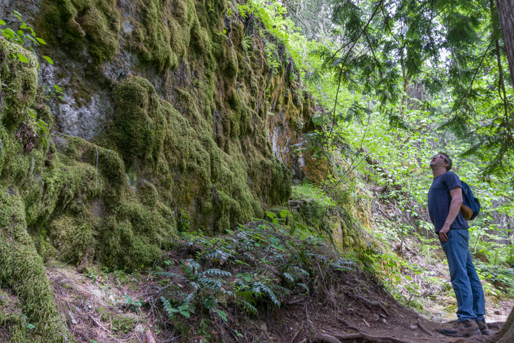
Midweek hiking for the win! We had the viewpoint to ourselves.

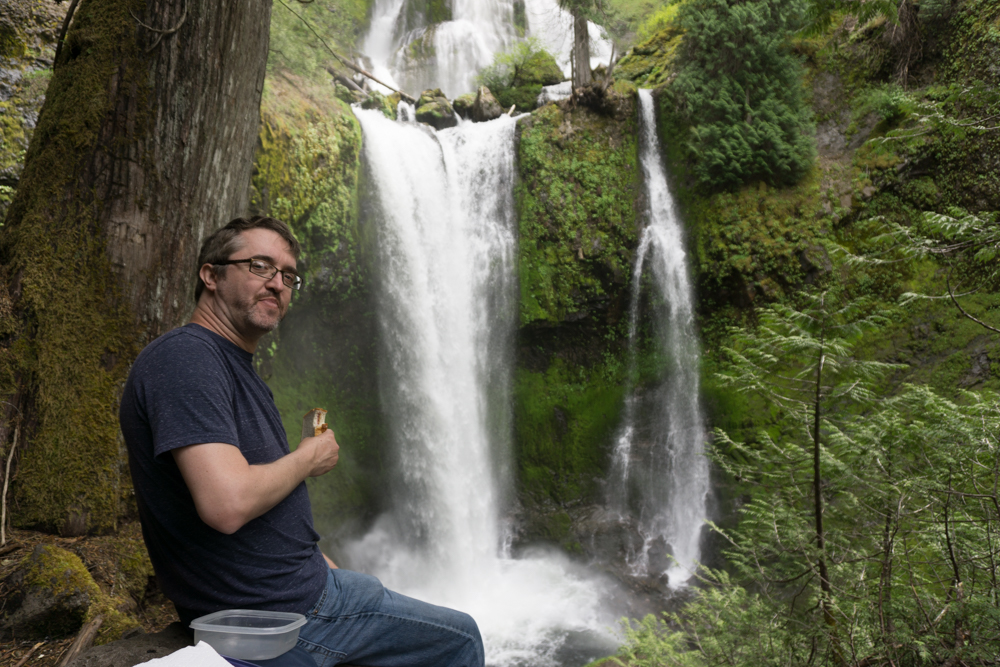
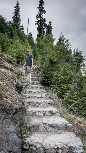
Lunchtime, with a view!

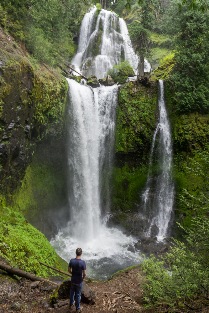
Dave climbed down to the lower viewpoint to try and give a little more perspective. As he said, it looked like something you’d expect to see in the jungles of Peru or something!

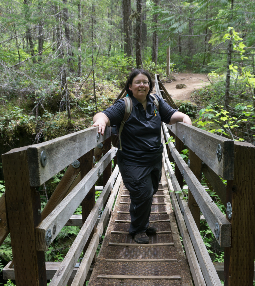
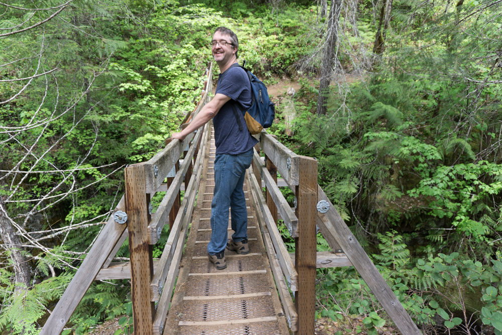
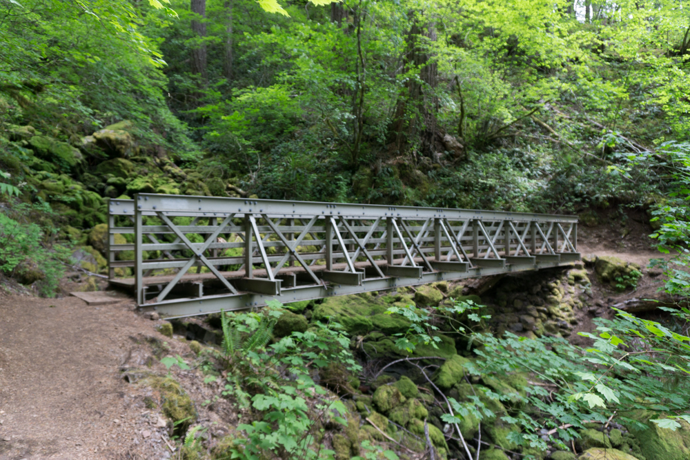
Finally we headed back, and Dave took a picture of me crossing the bridge at the beginning of the trail. It was a great hike, and a spectacular waterfall.

_

Beautiful spring day

Dave wanted a new headshot to show off his clean shaven look. He just finished acting in Becky’s New Car in Hillsboro, and shaved and got a haircut. So I snapped a quick pic of him.

It was such a nice day, he went out and played stickball with Barclay for a few minutes. Barclay is completely obsessed with the stickball, that’s all he wants to play. Got some great shots of Barclay suspended in mid-air. So cute!!

__

Explore Washington Vacation – Day 4 – The Penninsula

I think the only thing I don’t have a picture of from our trip is the actual Olympics! Because of the weather we ended up sort of skirting around the edge of the park, and the clouds only parted to give us a peek at the peaks a couple times.

We headed out from Forks that morning heading for Port Angeles. As we drove along through more boring forestry lands without any sort of view, I saw signs for Neah Bay – the westernmost tip of WA state. I hadn’t planned on the side trip, but we discussed it and decided what the heck, we might not be back out here for a while, we should go see it.

It was this sort of morning:

All along the way we stopped at pull offs to admire the beautiful ..um, I’m not sure what you call this body of water. It’s the water between us and Canada at the pointy end of Washington.

Finally we reached Neah Bay. It is a Native American village. They had a very good museum describing the history and the abuse of the Makah people, and how they almost lost their culture and had to get it back. Very interesting, and very sad.

We continued on to Port Angeles.

This GIANT oil rig was parked offshore. It is the Polar Pioneer, and apparently it’s some sort of drilling rig. It was HUGE!

We had a nice lunch at a little pub, where I got some very good poutine. Then we continued the long drive back to LYH. Along the way we stopped at a wayside for a nap, and saw this sign. We were discussing it when Dave started speculating on what sort of animals were OVER 8ft in length, and therefor didn’t require a leash. I was laughing too hard to correct him! 

We got back to LYH shortly after dark and found the trailer was just fine, as we had left it. Dave snuck off to the casino for one last evening of gambling. I stayed home and read and relaxed, but unfortunately I seem to have picked up a stomach bug from one of the many places we had eaten along the way. By the next morning all I wanted was to go home! So we cancelled the rest of the trip and headed home. We’ll have to save the East side of the state for next time.

And next year I hope we get a chance to come when the weather is nicer, and actually visit the park.

_

Explore Washington Vacation – Day 3 – The Beaches

On Day Three we left the trailer safely parked at LYH and headed for the Washington coast. For MANY years I have wnated to visit Kalaloch after seeing it in a Sunset Magazine, and we were finally getting around to heading there. We had been close, but it is just so far up the coast, we had never quite made the trip.

The trip is actually pretty boring. From Grays Harbor Highway 101 actually goes inland and stays there, so it’s just a long drive through mostly forestry land. We did stop for a quick look at a cool lake mid-morning.

We were also tempted by signs leading us to this ‘biggest tree’. Pretty damned big, indeed.

Finally we got what we were coming for – Kalaloch, and a view of the ocean.

We stopped and had lunch at the fancy lodge, but when we tried to get the price for a room no one could tell us up front how much it was, and suggested we look online, which seemed odd. So we decided to head on up the road and see whatever else there was to see.

Up the road was Beach 4. A long trail led down from the parking lot, to a strange striated pile of rocks you had to climb down to get to the beach. Luckily there was a sign to explain everything!

 We continued on to another ‘biggest tree’. Cedar, I think. It was big, and bits were falling off of it. We spent a bit of time photographing the ‘Mulder’ head there. Here’s Dave holding it at the bottom of the tree. Big tree!

Continuing on, we went to Ruby Beach. We got there a while before sunset, and I wanted to be sure and get some sunset shots, so we parked the car with a view and took a nap. It was worth waiting for!

When the sun was down we finally left, and headed to Forks. It was dark by the time we got there, so here’s a pic the next morning. We found this nice hotel off the main road. It actually had a suite, and for pretty cheap too. And the nice lady at the front desk steered us to a good restaurant in town.

Not bad. It was the first time I think that we took the trailer on vacation and left it somewhere while we went exploring and stayed in a hotel!

One more day…
_

Explore Washington Vacation – Day 2 – Seattle

So our plans for this day were to hit the Seattle Zoo, which we have never been to, and Seattle Center again, and just see how much time we had to burn.

The zoo was awesome! We love visiting zoos, and this one had really nice habitats, in fact sometimes it was hard to see where the boundaries of the habitats were. The animals seemed very relaxed. It rained on us a bit, but it was still a super nice visit.

THIS GUY was completely nuts! His picture is blurry because he could not sit still. He was running around, flying, flapping past us, climbing the walls, sittin on the bench, basically just all over the place. Fun bird to watch! And he was big, like a chicken. Busy bird!

I’m not even sure this owl was part of the Zoo. He was hanging out by some bird feeders watching the little birds that were cleaning up the seeds on the ground.

This guy was the odd man out at the party!

By afternoon we had seen the whole view and headed out in search of pizza. We tried a place that had great Yelp ratings near the zoo, but it was too foo-foo. We drove on into town and parked near the Space Needle, and found a good pizza joint a block or so away. Here is the view from where we parked. This will be more relevant in a moment…

 We stopped to snap a pic of the SN from the same point of view as the picture I took a couple years ago.

We debated quite a bit about going up in it. Number one – it’s really tall! That’s a long ways up! Number two – it was kind of expensive for just an elevator ride and a view.

Hey, I can see our car from up here! The silver Flex right in front of the black wall. And what the heck is on top of that building?

Had someone snap our picture. First time up for me!

We stayed up there watching the sun set and the ferries come and go until it was too cold, then headed back down.

Next tourist destination – ride the MONORAIL! Why? Because it’s a MONORAIL! You don’t need a reason!

Pretty!

Back to the view from in front of the museum. We waited to see the monorail go by and get a shot of that before we called it a night.

_

Explore Washington Vacation – Day one – Centralia

In November we had our big vacation planned for Yosemite. I had figured out where we could stay, where the best spots in the campground were, and reserved them way back in May or something. Then, just as we’re ready to go, word comes in that an early snowstorm is blowing in! After much debate we decided to cancel our trip South and stay closer to home, rather than end up snowed in at Yosemite.

So we headed North instead. Only makes sense right? Snows coming in, so you head North to get away from it! Well, in this case, we were just heading up to Seattle. We figured we could camp at Land Yacht Harbor, explore Seattle, and then take a day to go circle the Olympics.

It was a lousy grey day, as expected for mid-November.

We stopped in Centralia to begin with. There is a nice McMinamins Pub there for lunch.

Dave at lunch.

And the Fox theater, which we once toyed with the idea of buying and restoring. It would have destroyed us! So glad we passed on that adventure. Someone else has been fixing it up and it looks pretty nice on the outside, and they are holding performances so it must be pretty good inside too.

Well, back to the trailer, and head up to LYH. That is always a nice safe place to leave the trailer while we explore. I believe that evening we ‘explored’ our favorite steak house and may have located a casino that needed exploring as well.

Street parking in Centralia. I love that little trailer, it’s so damn cute!

To be continued…
_

OMSI Maker Mini-Fair

I saw our artist friend Tim Klein post that he would be down at the Mini-Maker Fair at OMSI with his ‘Yarn Car’. Since I had not gotten to see the yarn car in person yet, we decided to head down there and see what was up.

There was so much cool stuff going on!!

Human powered rides!

Crazy bicycles!

You know you’re in Portland when…

We had a nice long chat with a drone pilot who was flying his drone out over the Columbia river, which seemed pretty daring to me!

Finally we got to what we had originally come for: Tim Klein & The Yarn Car!!


Here’s how you polish a sphere.

Or maybe you want to just wood-work a sphere with amazing inlays.

One of my favorite pictures: New and old tech merge as a guy makes a Plein Air painting of a CNC Router.

Portland Center Stage Prop Dept brought a Dalek!

This guy was doing ice carving…

Finally stopped for lunch.

Hey, it’s Dave!

Last stop: the newly-opened Tillikum Bridge – for MAX and pedestrians only!

Dave with Dunce-cap spire 🙂 After a day in the hot sun, he is no longer amused…

__

Mt St Helens and Windy Ridge

We decided to head out for a day of exploration around the backside of our favorite local volcano – Mt St Helens.

Mt St Helens sits on the horizon where we live. It is something we see every day (along with Mt Hood and Mt Adams), and everyone took it for granted until 1980 when it started huffing out clouds of smoke and eventually exploded in an eruption that gave us all a very graphic example of what the word ‘devastation’ really means. Ridge after ridge around the mountain was cleared down to bare rock or covered in ash. Some of the ash even rained down over our homes. When we went to see it a few years after the eruption, it was like a desert where once a beautiful forest had stood. Now when we look at the mountain it’s flat top reminds us at a glance that we have a real live volcano in our backyard.

For many years we took an annual trip from Yakima up to Windy Ridge, often with our Miata friends, and admired the view looking down into the crater. We have also come in on the West side to the observatory. It’s an amazing place to visit, from either direction. This time we decided to wind up the backroads to Windy Ridge and see how it was doing. So we packed a picnic lunch, grabbed the camera, and headed out for a day of adventure.

Driving around the backside of Mt St Helens takes you through woods that were pretty much untouched by the blast, except for creeks and rivers that were flooded by the sudden glacier melts that occurred, causing mud flows to tear down the canyons and valleys. Everything is recovering so well though, that it is hard to see the damage anymore, even at overlooks that were established for people to stop and admire the changes in the landscape.

Then you come to the Muddy River at Lava Canyon

 Can you see Dave on the rocks looking over the canyon?

 We added a rock to a cairn we passed on our way along a trail that took us to another vantage point of the muddy river. Too bad the clouds were hiding the mountain at the other end of the canyon. We should have realized then that this just wasn’t going to be our day for viewing the mountain itself.

 On to Lava Canyon, where water has carved a steep channel through lava rock.

 Very cool place, with lots of signs warning you that if you fall in that water, you will die and they will never find your body, or something to that effect. That was the take-away, anyway. That water was fast and furious as it disappeared into the bulbous lava forms sticking up out of the forest.

We backtracked out of the Ape Canyon / Lava Canyon area, and continued heading East towards Windy Ridge. We stopped along the road at this still wiped out canyon and ate our lunch while enjoying the complete peacefulness of the forest. I don’t think a single car drove by while we were enjoying our lunch. It was just us and the birds in the trees.

Further up the road we stopped at a wide spot to enjoy this overlook of  what I think was the Clearwater Creek drainage. What an amazing view!

Our sturdy Flex made the ride nice and smooth over the terrible forest service roads, which had a lot of broken pavement. It was the right choice for this trip! The Miata would have been beat to death.

 Finally we arrived at Windy Ridge, with it’s amazing view of…clouds. Lots and lots of clouds.

 Beautiful view of Spirit Lake though. We had a lovely panorama of the devastated area.

The devastated area has recovered considerably. There was a time when this was all just covered in brown ash. The effects of the eruption are still clearly visible in the three zones. Zone 1 – the ridges were blown clean down to bedrock. They are still bare of trees, but starting to show a cover of green.

Then there is the zone farther out where the trees were all knocked down, and still lay pointing away from the source of the blast. More baby trees are popping up in this area. 

In the third zone the trees were killed by the heat of the eruption, but remain standing. This area is recovering even better. It’s amazing to see how one ridge is in the blowdown zone, and the next the trees were left standing. 

That is Mt St Helens for you – such a beautiful, amazing place. We stopped at another overlook on the way back from Windy Ridge and enjoyed the peacefulness of the scene, the little pops of color from wildflowers appearing on the hillside. We waited a little bit, but the mountain remained hidden in the clouds. It was just one of those days.

 But we had a great time anyway, as we always do when out adventuring together.

_