Tom, Dick, and Harry Mountain

I screwed up my courage and headed off on another solo adventure – to Tom, Dick, and Harry Mountain. This is my first hike outside of the Gorge. It is a 6 mile hike, with 1700ft elevation gain, so the most strenuous hike I’ve done so far. It is up by Mt Hood, with spectacular views, and along the way you pass by Mirror Lake, with a beautiful reflection of Mt Hood. On a clear day, anyway.

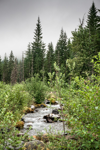
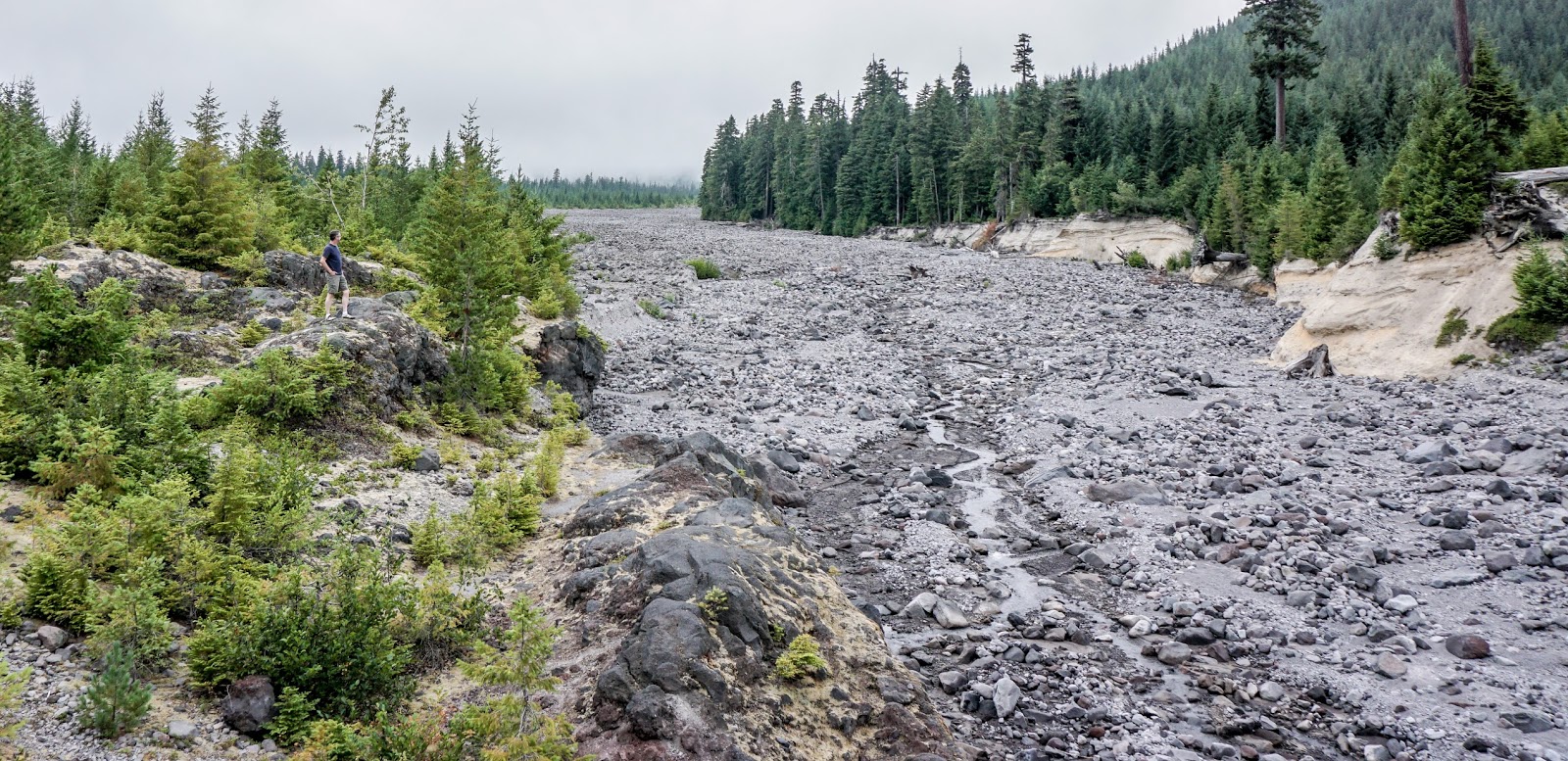
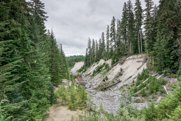
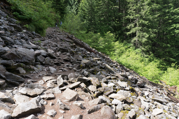
The trailhead is right on Highway 26, so I found a spot and started walking. Among other firsts, I got to cross a scree slope, which I’ve always thought would be pretty scary, but the well-used trail was actually quite stable on the slope. I crossed several of these by the time I was done.

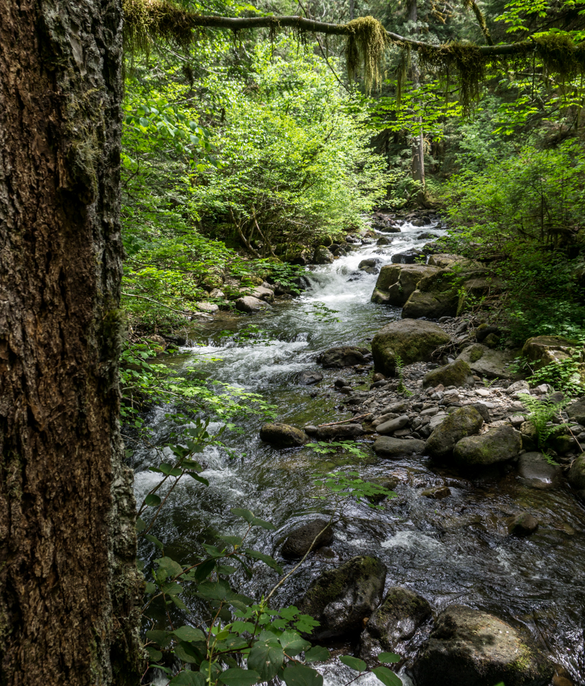
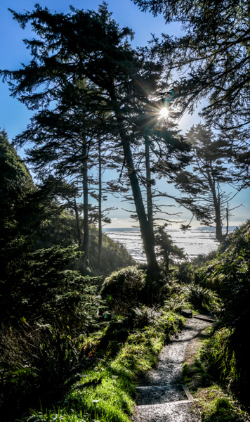
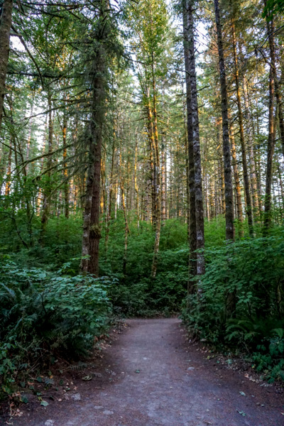
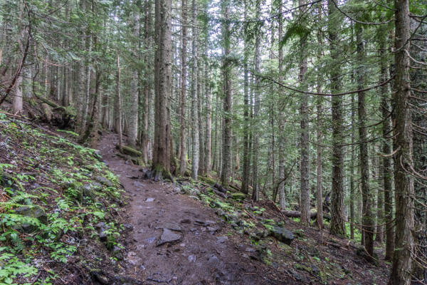
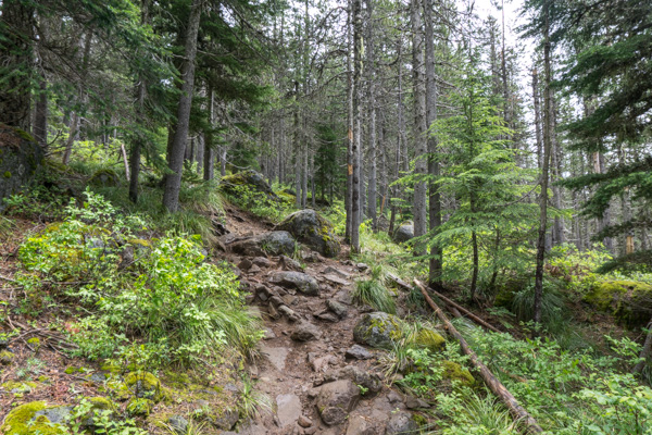
The trail continued on through lovely forests. Everything was a little muddy, because it had been raining, and was actually raining off and on during my hike. Enough that everytime I thought it was over and tried to take off my rain jacket, it would start sprinkling again. So I had my jacket and hat on the whole hike.

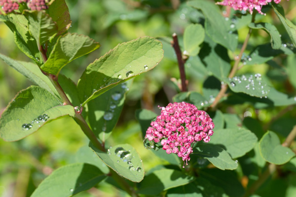
Notice the rhododendrons blooming along the trail – neat!

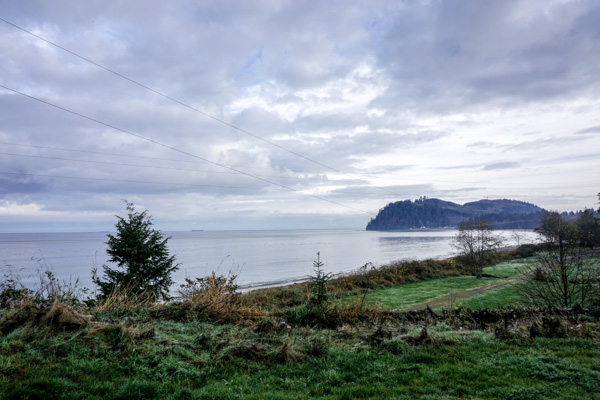
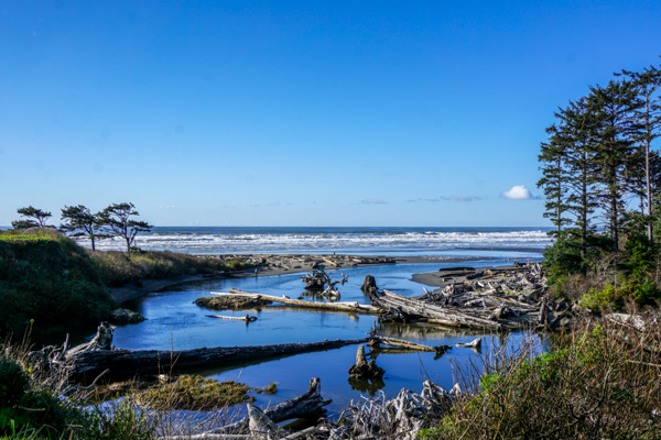
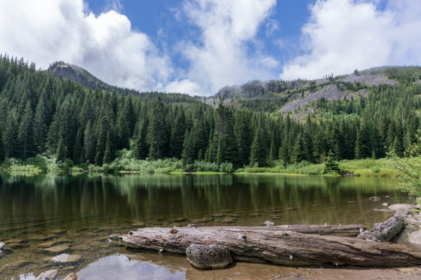
Finally I came to Mirror Lake, which is only a mile and a half in. This was a nice place to stop and rest a little, have a snack, and enjoy the view. That lump on top of the ridge straight ahead is where I’m going. At this point I was looking at it and thinking, no, there’s really no way I’m going all the way up there! It looked pretty high from the lake.

I started to walk around the lake to see the view of Mt Hood, but I could tell it was clouded over. I got to the trail to Tom Dick and Harry and thought about it. No way, I’ll never make it, I told myself. There was a family at the trail junction with three little kids, and they said ‘you go ahead, we don’t want to slow you down!’ I thought, NO ONE has ever slowed ME down, I’m the slowest hiker out there! But seeing them was the push I needed, and I thought, I’ll just go up the trail a ways and see what it looks like – I can always turn around when  I’m halfway tired.

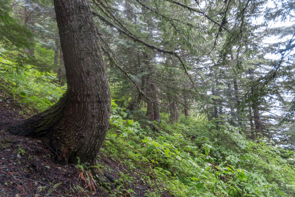
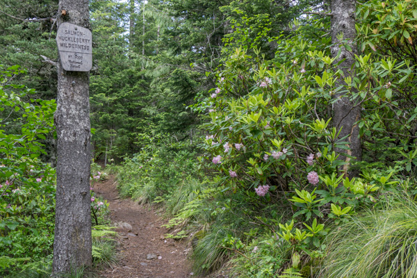
Another first for me – hiking in a Wilderness area!
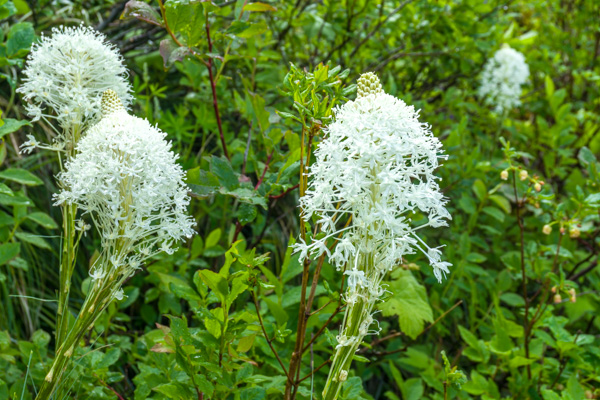
Bear Grass

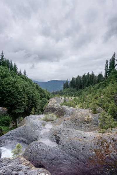
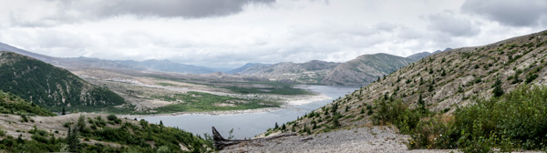
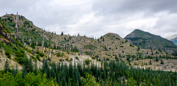
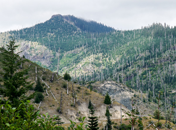
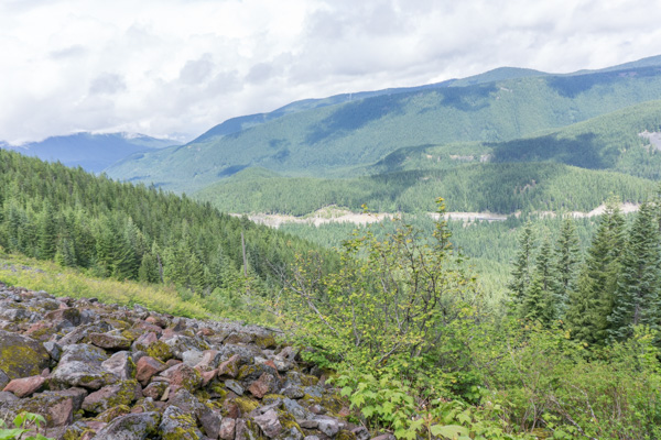
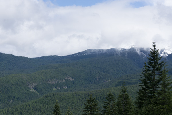
A pretty view of the valley, but no mountain.

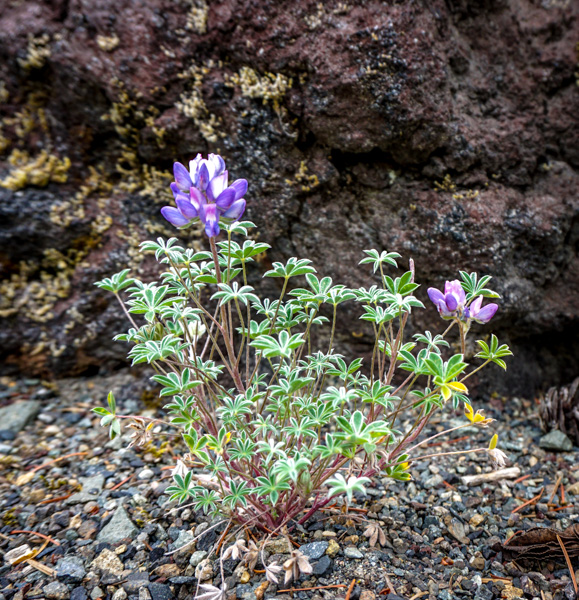
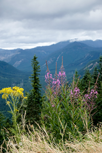
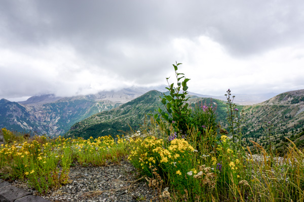
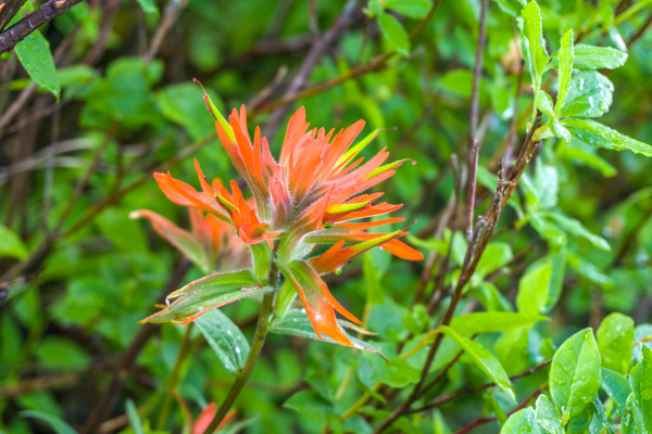
Pretty, whatever it is! I think it’s Indian Paintbrush.

Still plugging along, another beautiful viewpoint, but no mountain.

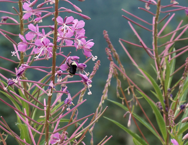
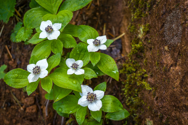
Pretty little flowers,

Getting closer to the top. Still no mountain.

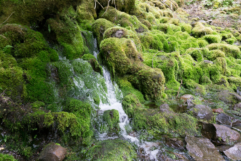
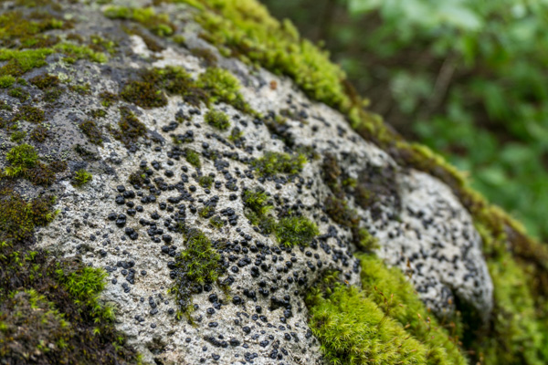
Funky moss on a rock.

I was stopped for a rest from the relentless uphill climb, and saw a couple coming downhill, so I chatted them up about the hike. They said it was worth it, and they got a view of the mountain at the top! But they warned me, I was about ten minutes from the rockpile, and after that it got ‘climby’. Ok, not sure what that means…
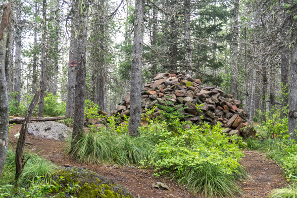
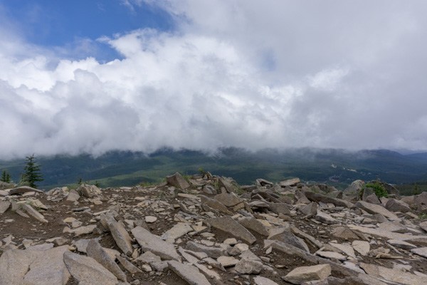
Rockpile!

Oh, THAT’S what ‘climby’ means…

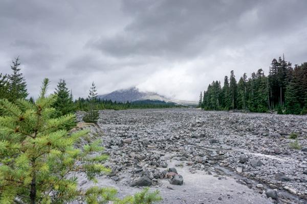
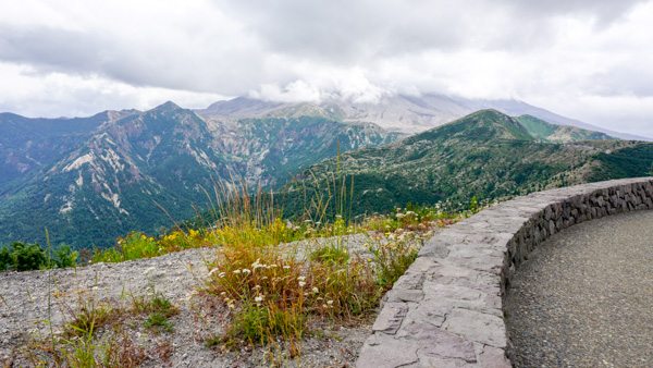
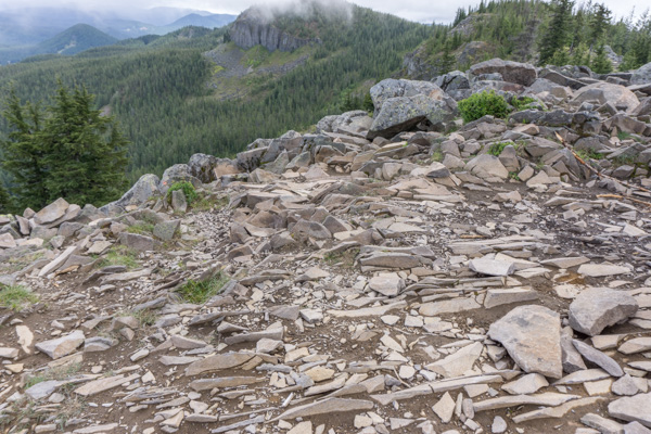
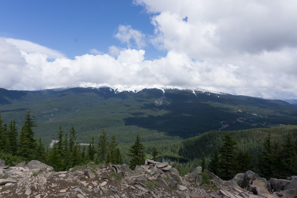
So, it looked like that off and on for the last 20 minutes, and then finally, I climbed up a rocky bit, and tah dah! On top of the world! Looking down on Mirror Lake – and no mountain.

Tom Dick and Harry is cool, look at all those rocks pushed together! I read it was formed through glacial action, as opposed to all the basalt/lava I’ve been seeing in the gorge.

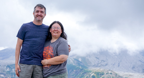
There was another family at the top and I chatted with them. They were visiting from North Carolina, and they were eating lunch and hoping it would clear up and give them a view before they had to head back down.

Nope.

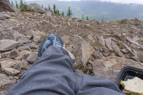
So I sat down against a boulder to eat my lunch..and it started SNOWING on me!!

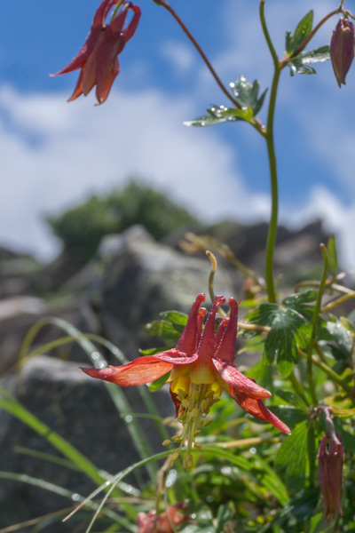
The snow cleared up and I walked around and took some pictures. I think this is Columbine.

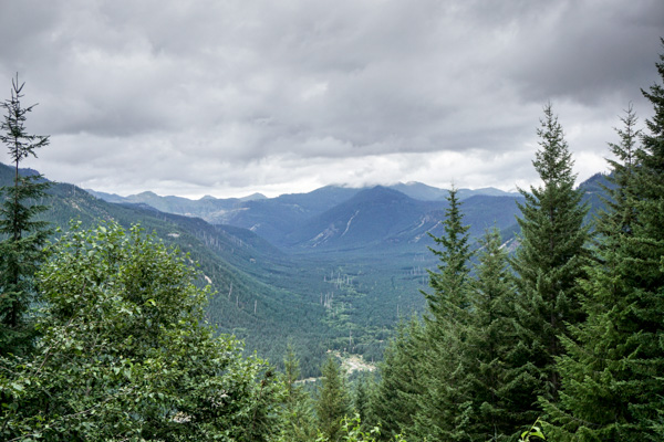
TD&H also has a beautiful view of Mt Jefferson to the south. On a clear day…

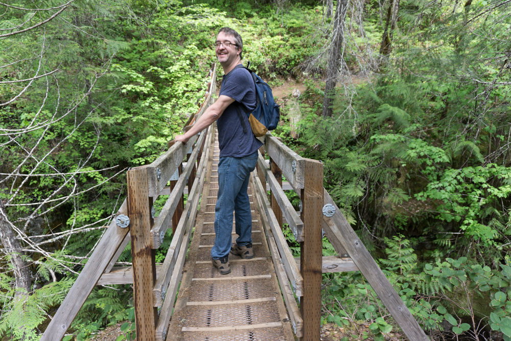
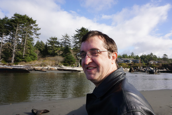
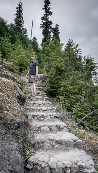
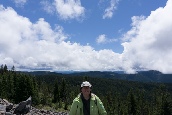
So my new friends and I took pictures for each other, and they reluctantly headed on down. Here I am with Mt Cloudy in the background.

Now I had the top of the world to myself, so I settled down on top of a boulder and decided to soak up the sun and rest a bit.

I closed my eyes and opened them when a raven flew by so close I could hear his feathers rustling! Cool. I closed my eyes again. So quiet. Just the wind…and some rocks clinking together. I heard it again. I was not alone up here!

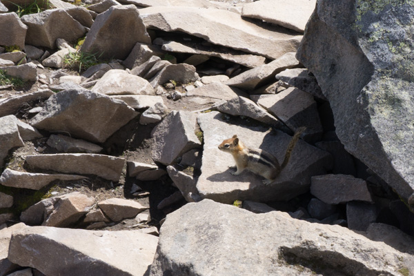
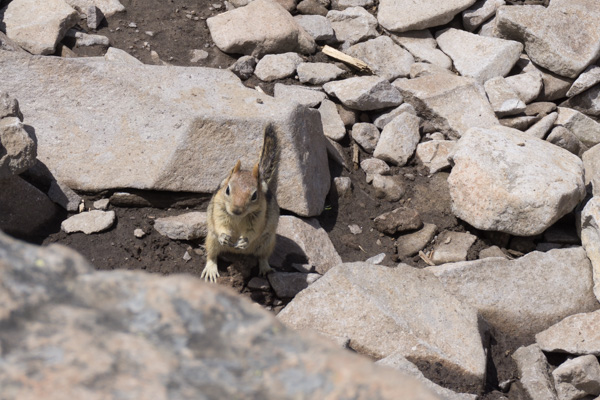
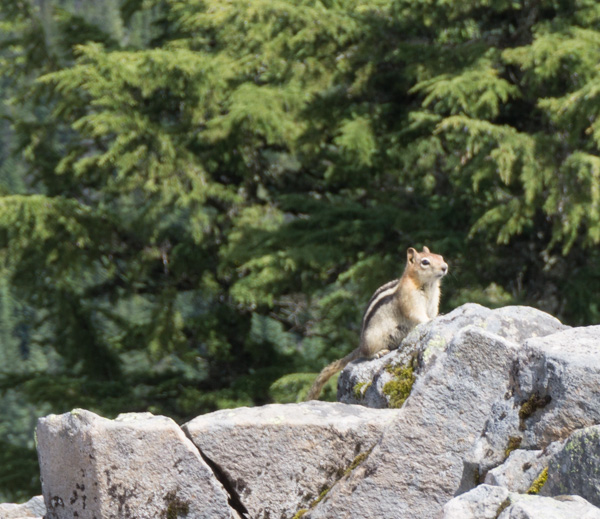
Golden-mantled Ground Squirrels! There were two of them, running around. One even came up and sat right next to me on the boulder, and then took off before I could catch a selfie with him!

After about an hour of resting on the top, I decided to head back down. It was beautiful, and I can’t wait to go back. On a clear day, next time!

___

Panther Falls and Falls Creek Falls (and Cave)

For my weekly outdoor adventure I decided to drag Dave along. For one thing, I hadn’t forced him out into the woods lately, and I thought it would be good for him. For another thing, it was a LONG drive out to the woods, and I didn’t want to be alone if I broke the Miata.

So we headed down Highway 14 to White Salmon, and headed north into the Gifford Pinchot National Forest. We had a guidebook, ‘Curious Gorge’, but in retrospect next time I’ll bring some accurate maps. This wasn’t like driving the old highway to Multnomah Falls. Forest roads are winding and poorly marked, and I was a bit worried we were going to get lost more than once! And it’s not like someone is going to come along and help you find your way, there’s not a lot of people out there in the middle of the week!

First stop: Panther Creek Falls.

I was told this is the most spectacular waterfall you’ve never heard of. There isn’t even really a trailhead, just a wide spot of rutted dirt to park alongside the road. Then you walk back along the road about 50 ft and there’s an arrow hand-spray painted on the road that says ‘falls’ – we almost missed it. Follow the little path there into the bushes, and suddenly you are walking on a lovely path through tall trees.

The path goes down to follow this stream a short distance, protected by a fence, and then to a viewing platform for this:

 It’s difficult to capture how big this is! It’s two streams flowing down this huge wall of rock.

 The streams that tumble down to the waterfall are pretty impressive on their own.

So that was a very short walk to a very spectacular waterfall. People told me if it wasn’t located deep in the woods, everyone would be flocking to it. I agree!

 Next stop – Falls Creek Cave.

We didn’t do much at Falls Creek Cave except look at it and change our minds about going any further. I think I would do this if I came with more people, but with just the two of us, if someone got hurt, it would be bad. We decided to hold off on this adventure.

Next stop: Falls Creek Falls

So, again, people told me this is the best waterfall in the Gorge (though it’s quite a ways from the Gorge itself. They assured me it was worth it. It’s a two mile hike in through a lovely forest along a river for much of the hike.

One neat feature, again – hard to capture in photos, was this section where you cross over a little stream coming down the hill, and the rocky area the water is coming out of is all covered in beautiful moss. It was really other-worldly.
The trail continued along past this neat rock wall all covered in moss and ferns
Finally we heard the falls, and looking up, way up, we caught sight of it – the upper falls. Seeing photos of it did not prepare me for how HUGE it was, and the spectacular roar of the water, and the rush of wind coming off of it. It was amazing!

Midweek hiking for the win! We had the viewpoint to ourselves.

Lunchtime, with a view!

Dave climbed down to the lower viewpoint to try and give a little more perspective. As he said, it looked like something you’d expect to see in the jungles of Peru or something!

Finally we headed back, and Dave took a picture of me crossing the bridge at the beginning of the trail. It was a great hike, and a spectacular waterfall.

_

Explore Washington Vacation – Day 4 – The Penninsula

I think the only thing I don’t have a picture of from our trip is the actual Olympics! Because of the weather we ended up sort of skirting around the edge of the park, and the clouds only parted to give us a peek at the peaks a couple times.

We headed out from Forks that morning heading for Port Angeles. As we drove along through more boring forestry lands without any sort of view, I saw signs for Neah Bay – the westernmost tip of WA state. I hadn’t planned on the side trip, but we discussed it and decided what the heck, we might not be back out here for a while, we should go see it.

It was this sort of morning:

All along the way we stopped at pull offs to admire the beautiful ..um, I’m not sure what you call this body of water. It’s the water between us and Canada at the pointy end of Washington.

Finally we reached Neah Bay. It is a Native American village. They had a very good museum describing the history and the abuse of the Makah people, and how they almost lost their culture and had to get it back. Very interesting, and very sad.

We continued on to Port Angeles.

This GIANT oil rig was parked offshore. It is the Polar Pioneer, and apparently it’s some sort of drilling rig. It was HUGE!

We had a nice lunch at a little pub, where I got some very good poutine. Then we continued the long drive back to LYH. Along the way we stopped at a wayside for a nap, and saw this sign. We were discussing it when Dave started speculating on what sort of animals were OVER 8ft in length, and therefor didn’t require a leash. I was laughing too hard to correct him! 

We got back to LYH shortly after dark and found the trailer was just fine, as we had left it. Dave snuck off to the casino for one last evening of gambling. I stayed home and read and relaxed, but unfortunately I seem to have picked up a stomach bug from one of the many places we had eaten along the way. By the next morning all I wanted was to go home! So we cancelled the rest of the trip and headed home. We’ll have to save the East side of the state for next time.

And next year I hope we get a chance to come when the weather is nicer, and actually visit the park.

_

Explore Washington Vacation – Day 3 – The Beaches

On Day Three we left the trailer safely parked at LYH and headed for the Washington coast. For MANY years I have wnated to visit Kalaloch after seeing it in a Sunset Magazine, and we were finally getting around to heading there. We had been close, but it is just so far up the coast, we had never quite made the trip.

The trip is actually pretty boring. From Grays Harbor Highway 101 actually goes inland and stays there, so it’s just a long drive through mostly forestry land. We did stop for a quick look at a cool lake mid-morning.

We were also tempted by signs leading us to this ‘biggest tree’. Pretty damned big, indeed.

Finally we got what we were coming for – Kalaloch, and a view of the ocean.

We stopped and had lunch at the fancy lodge, but when we tried to get the price for a room no one could tell us up front how much it was, and suggested we look online, which seemed odd. So we decided to head on up the road and see whatever else there was to see.

Up the road was Beach 4. A long trail led down from the parking lot, to a strange striated pile of rocks you had to climb down to get to the beach. Luckily there was a sign to explain everything!

 We continued on to another ‘biggest tree’. Cedar, I think. It was big, and bits were falling off of it. We spent a bit of time photographing the ‘Mulder’ head there. Here’s Dave holding it at the bottom of the tree. Big tree!

Continuing on, we went to Ruby Beach. We got there a while before sunset, and I wanted to be sure and get some sunset shots, so we parked the car with a view and took a nap. It was worth waiting for!

When the sun was down we finally left, and headed to Forks. It was dark by the time we got there, so here’s a pic the next morning. We found this nice hotel off the main road. It actually had a suite, and for pretty cheap too. And the nice lady at the front desk steered us to a good restaurant in town.

Not bad. It was the first time I think that we took the trailer on vacation and left it somewhere while we went exploring and stayed in a hotel!

One more day…
_

Explore Washington Vacation – Day 2 – Seattle

So our plans for this day were to hit the Seattle Zoo, which we have never been to, and Seattle Center again, and just see how much time we had to burn.

The zoo was awesome! We love visiting zoos, and this one had really nice habitats, in fact sometimes it was hard to see where the boundaries of the habitats were. The animals seemed very relaxed. It rained on us a bit, but it was still a super nice visit.

THIS GUY was completely nuts! His picture is blurry because he could not sit still. He was running around, flying, flapping past us, climbing the walls, sittin on the bench, basically just all over the place. Fun bird to watch! And he was big, like a chicken. Busy bird!

I’m not even sure this owl was part of the Zoo. He was hanging out by some bird feeders watching the little birds that were cleaning up the seeds on the ground.

This guy was the odd man out at the party!

By afternoon we had seen the whole view and headed out in search of pizza. We tried a place that had great Yelp ratings near the zoo, but it was too foo-foo. We drove on into town and parked near the Space Needle, and found a good pizza joint a block or so away. Here is the view from where we parked. This will be more relevant in a moment…

 We stopped to snap a pic of the SN from the same point of view as the picture I took a couple years ago.

We debated quite a bit about going up in it. Number one – it’s really tall! That’s a long ways up! Number two – it was kind of expensive for just an elevator ride and a view.

Hey, I can see our car from up here! The silver Flex right in front of the black wall. And what the heck is on top of that building?

Had someone snap our picture. First time up for me!

We stayed up there watching the sun set and the ferries come and go until it was too cold, then headed back down.

Next tourist destination – ride the MONORAIL! Why? Because it’s a MONORAIL! You don’t need a reason!

Pretty!

Back to the view from in front of the museum. We waited to see the monorail go by and get a shot of that before we called it a night.

_

Explore Washington Vacation – Day one – Centralia

In November we had our big vacation planned for Yosemite. I had figured out where we could stay, where the best spots in the campground were, and reserved them way back in May or something. Then, just as we’re ready to go, word comes in that an early snowstorm is blowing in! After much debate we decided to cancel our trip South and stay closer to home, rather than end up snowed in at Yosemite.

So we headed North instead. Only makes sense right? Snows coming in, so you head North to get away from it! Well, in this case, we were just heading up to Seattle. We figured we could camp at Land Yacht Harbor, explore Seattle, and then take a day to go circle the Olympics.

It was a lousy grey day, as expected for mid-November.

We stopped in Centralia to begin with. There is a nice McMinamins Pub there for lunch.

Dave at lunch.

And the Fox theater, which we once toyed with the idea of buying and restoring. It would have destroyed us! So glad we passed on that adventure. Someone else has been fixing it up and it looks pretty nice on the outside, and they are holding performances so it must be pretty good inside too.

Well, back to the trailer, and head up to LYH. That is always a nice safe place to leave the trailer while we explore. I believe that evening we ‘explored’ our favorite steak house and may have located a casino that needed exploring as well.

Street parking in Centralia. I love that little trailer, it’s so damn cute!

To be continued…
_

Moulton Falls

We don’t wander up to Battle Ground much since we sold the farm, but we did make a nice mid-summer trip up to wander around Moulton Falls, because it’s beautiful.

We walked along the river and watched people jumping in off the rocks.

The bridge to the upper trail is a local landmark.

We crossed the highway to the waterfalls on the other side of the road.

While I was taking pictures of the waterfall, Dave was taking pictures of me!

By the time we walked back to the car, we were almost out of light, and the trees were lit with a pretty golden glow from the sunset. What a lovely place!

_

Mt St Helens and Windy Ridge

We decided to head out for a day of exploration around the backside of our favorite local volcano – Mt St Helens.

Mt St Helens sits on the horizon where we live. It is something we see every day (along with Mt Hood and Mt Adams), and everyone took it for granted until 1980 when it started huffing out clouds of smoke and eventually exploded in an eruption that gave us all a very graphic example of what the word ‘devastation’ really means. Ridge after ridge around the mountain was cleared down to bare rock or covered in ash. Some of the ash even rained down over our homes. When we went to see it a few years after the eruption, it was like a desert where once a beautiful forest had stood. Now when we look at the mountain it’s flat top reminds us at a glance that we have a real live volcano in our backyard.

For many years we took an annual trip from Yakima up to Windy Ridge, often with our Miata friends, and admired the view looking down into the crater. We have also come in on the West side to the observatory. It’s an amazing place to visit, from either direction. This time we decided to wind up the backroads to Windy Ridge and see how it was doing. So we packed a picnic lunch, grabbed the camera, and headed out for a day of adventure.

Driving around the backside of Mt St Helens takes you through woods that were pretty much untouched by the blast, except for creeks and rivers that were flooded by the sudden glacier melts that occurred, causing mud flows to tear down the canyons and valleys. Everything is recovering so well though, that it is hard to see the damage anymore, even at overlooks that were established for people to stop and admire the changes in the landscape.

Then you come to the Muddy River at Lava Canyon

 Can you see Dave on the rocks looking over the canyon?

 We added a rock to a cairn we passed on our way along a trail that took us to another vantage point of the muddy river. Too bad the clouds were hiding the mountain at the other end of the canyon. We should have realized then that this just wasn’t going to be our day for viewing the mountain itself.

 On to Lava Canyon, where water has carved a steep channel through lava rock.

 Very cool place, with lots of signs warning you that if you fall in that water, you will die and they will never find your body, or something to that effect. That was the take-away, anyway. That water was fast and furious as it disappeared into the bulbous lava forms sticking up out of the forest.

We backtracked out of the Ape Canyon / Lava Canyon area, and continued heading East towards Windy Ridge. We stopped along the road at this still wiped out canyon and ate our lunch while enjoying the complete peacefulness of the forest. I don’t think a single car drove by while we were enjoying our lunch. It was just us and the birds in the trees.

Further up the road we stopped at a wide spot to enjoy this overlook of  what I think was the Clearwater Creek drainage. What an amazing view!

Our sturdy Flex made the ride nice and smooth over the terrible forest service roads, which had a lot of broken pavement. It was the right choice for this trip! The Miata would have been beat to death.

 Finally we arrived at Windy Ridge, with it’s amazing view of…clouds. Lots and lots of clouds.

 Beautiful view of Spirit Lake though. We had a lovely panorama of the devastated area.

The devastated area has recovered considerably. There was a time when this was all just covered in brown ash. The effects of the eruption are still clearly visible in the three zones. Zone 1 – the ridges were blown clean down to bedrock. They are still bare of trees, but starting to show a cover of green.

Then there is the zone farther out where the trees were all knocked down, and still lay pointing away from the source of the blast. More baby trees are popping up in this area. 

In the third zone the trees were killed by the heat of the eruption, but remain standing. This area is recovering even better. It’s amazing to see how one ridge is in the blowdown zone, and the next the trees were left standing. 

That is Mt St Helens for you – such a beautiful, amazing place. We stopped at another overlook on the way back from Windy Ridge and enjoyed the peacefulness of the scene, the little pops of color from wildflowers appearing on the hillside. We waited a little bit, but the mountain remained hidden in the clouds. It was just one of those days.

 But we had a great time anyway, as we always do when out adventuring together.

_

Trout Lake 2015


Time again for the annual trip to Trout Lake to hang out with my Airstream friends. We packed up the trailer, the dogs, and it seemed like more miscellaneous ‘stuff’ than ever before. Maybe it just felt that way because the Flex is so small and the Van was so big! We headed off after work on Thursday so we could get in an extra day.

We rolled into town to find a thunderstorm hiding the mountain top and obscuring the sunset.

DSC02551

We got settled in, said hello to everyone, and soon after crashed for the night. As I lay in bed in the complete darkness, I thought my eyes were playing tricks as I saw flashes, but the thunder told us it was the lightening storm. Kind of cool.


DSC02553

The next day the Airstreams kept rolling in. All our usual friends, and a few we had missed last year. A sad trip for our friends Carolyn and Loren, as they had just lost their beautiful German Shepherd Cosmo. Cosmo had been a fixture at the rally for 7 years, where he would hang out by the campfire with them, but if Mom and Dad weren’t together, he would patrol the camp going back and forth between them, checking on them. Such a good boy. It was so sad to hear of his passing.


DSC02555

Soon there were enough people to stir up a card game, which Dave got in on.


DSC02556

Puzzles came out too …


DSC02557

and guitars. Camping is the life!


DSC02558

DSC02559

The dogs hung out in their dog-yard. I had started prepping the trailer a couple weeks before we left, and was happy to find everything worked. We used the fridge all weekend, and only needed to run the furnace a couple nights because the weather was so mild. With the LED lights, we didn’t even come close to running out of power.


DSC02563

DSC02566

Our friend Chris showed up with his Caravel, and his new/old Bronco.


DSC02567

Cory, Carolyn, Jerry, Patsy, Karen, Dave and Loren entertain themselves. I think this was shortly before they decided to ‘make it interesting’ and start playing for pennies!


DSC02569

Barclay can watch the activities from bed!


DSC02570

When we have the dogs we usually fold the dinette down into a bed all day.


DSC02577

Both dogs like laying in the ‘doghouse’ under the bed. Navi decided it was hers and growled furiously if Barclay tried to invade it. Which he occasionally did, just to annoy her.


DSC02580

DSC02582

Airstreams of all shapes and sizes – vintage, Interstate, and Argosy!


DSC02586

Greg got the fire all stirred up


DSC02588

Sunset over the creek behind the campground


DSC02591

So many friends, good food, jamming around the campfire at night (I even brought my guitar this time) – wears you out. I’ve never slept so well in my life!


The next morning we headed over to the county park to partake of their showers. You can shower in the Caravel, but why make a mess in there, when you can make a mess in someone else’s shower instead? Seemed like a good deal to me! Then we went to the Ranger Station and got a map and directions for the local attractions.

DSC02593

We wandered off into the woods to find the Big Lava Bed. Turns out it is indeed big, but hard to access, and I didn’t even really get any pictures of it!


DSC02598

Back to camp, this is the view at the porta-john – one of the prettiest in camp!


DSC02603

Flags were flying in the wind. All that wind blowing through the trees around camp made for a fabulous afternoon nap while Dave went and played cards.


DSC02605

Peanut butter kongs keep the dogs occupied.


DSC02610

In the evening I play guitar until my fingers were too sore to play anymore, so I packed it in, and grabbed my camera. The wind had blown away the clouds. I finally had a chance (and the equipment and know-how, to do this:

DSC02626-2


DSC02612

Cozy little trailer.

DSC02651

The next morning we headed up to see Langfield Falls. Along the way we stopped for views of Mt Adams and Beargrass.


DSC02666

DSC02673

Thanks to the dry winter, the falls was only running down one side, instead of covering the whole rock.


DSC02677


DSC02687

We saw a sign to Mosquito Lake, and decided we HAD to check that out. A whole lake of mosquitoes, how fun! (sarcasm) But alas, there were no mosquitoes. It was actually very nice. Must have hit it at just the right time of year. It made us wish we had a kayak!

On the way up there we had to stop to let a small group of Elk stroll across the road. Of course I didn’t get a picture of THAT!

On the way back, we stopped by the Big Tire. Seriously, it’s on the MAP.

DSC02694

Yup, that’s big alright.


DSC02695

Coming back we had a peek at Sleeping Beauty from a different angle. Not quite as face-like from over here.

We went back through town and headed out past the campground in the other direction looking for the biggest Ponderosa Pine in WA – known as The Big Tree.

DSC02698

I suppose it’s kinda big.


DSC02699

DSC02700

Pretty, delicate little flowers in this area.

DSC02708

DSC02725


Back to Trout Lake, to stop for lunch at the Café/Gas Station/Espresso/Ice Cream Shop

DSC02728

As you might guess, the only place in town. But actually kind of awesome.


DSC02731

Back to the trailer for lunch..


DSC02733

And Siesta. I cleaned out a drawer in the trailer and found a bunch of paperbacks. Dave started reading a Star Wars book he had tried to read on previous trips, and I found an old X Files novel. What a great way to geek out during afternoon downtime!


DSC02735

I take this picture every year!


DSC02737

I never get tired of looking at the mountain!

At sunset I took the dogs for a walk, looked up, and saw the setting sun had somehow created a rainbow in the clouds, right over Sleeping Beauty’s face! I ran the dogs all the way back to the trailer to get my camera and get a shot before the phenomenon disappeared!

DSC02741

DSC02742

I love it! And I love Sleeping Beauty.


DSC02744

One more night of singing around the fire, followed by a peaceful night’s sleep, and in the morning, it was time to go.

DSC02746

Trout Lake is always over too soon! We love visiting with our friends, catching up, singing songs, watching the campfire, sharing potlucks, playing games, taking naps, and playing music. We will get together again before summer is over, but Trout Lake is an awesome start to the season. Many thanks to our friends Janet and Gary for pulling us all together for another year.


_

CA Adventure Part 5–San Francisco


We headed out of Yosemite into the endless flat farmland of the central valley. Not much to say about that. We ended up in:


20150316-DSC00516

Modesto!

We stayed at a hotel right in town. ON the way in I had looked up a place for dinner, and Yelp recommended a pizza place attached to a motorcycle shop. When we checked in we mentioned it to the guy at the front desk to get a local’s opinion – ‘oh, that place, no, that’s a dive. Besides, it’s too full of kids and families. I’ll tell you where to go…’ He gave us the name of another place. When I looked it up on Yelp, people pretty much said it was a dank dive bar. We went with the pizza place, and it was good!


20150316-DSC00509

Not much to say about Modesto, but in the morning we had a walk around and saw this historic mansion right behind our hotel. Kind of cool. Unfortunately, not open on Mondays.


20150316-DSC00518

We continued the long, boring drive back to civilization.


20150316-DSC00523

One of the things on my to-do list was to drive over the Marin Headlands and get a picture of the bridge from up high. There were a surprising number of people doing the same thing, and the pull-offs were actually packed full! I was really happy with this shot though.


20150316-DSC00537

We continued up to this old battery Rathbone – McIndoe.


20150316-DSC00544

Back around to the bridge, we took another loop up to see if we could stop at any of the other overlooks, but they were packed. Though we had some nice views of the beaches.


20150316-DSC00546

There’s something about seeing that iconic bridge that is breathtaking every time. It’s so amazing to be looking at it in person!


20150316-DSC00548


We finally headed across it to spend some time in the city before heading to San Jose for our flight.


20150316-DSC00563

The Palace of Fine Arts. We walked all around the outside. They were between exhibits, so they only had a tiny inside area open to the public.


20150316-DSC00564

Dave found a Weeping Angel. Well, maybe not, but a bit creepy, all the same.


20150316-DSC00565


20150316-DSC00570

Down to Fisherman’s Warf…We wandered around and stopped for an In & Out burger then went and found a bench to eat at while watching the bay. We actually planned this lunch specifically to have one of those before we left CA, because we kept hearing how great they were – it was the most bland burgers we’ve had! Now I have to question the taste of anyone who tells me they thing those are awesome. They were the same quality I would expect out of your basic cafeteria – nothing to write home about.


20150316-DSC00571

With lunch out of the way we went and drove that steep windy road, because we hadn’t done it before, and it seems like everyone should do it at least once! Then we went and checked out the tower on the hill. But time was running out, we had to head back to San Jose.


20150316-DSC00576

This is how the San Jose Airport greets you. Is it just me, or are the disembodied hands kind of creepy? It’s not just me, right? Up close it was kind of a cool artwork. It was mesh panels with round white pieces – think of large pop bottle caps stuck into a chain link fence –that were the pixels to make up the image. Creative!


20150316-DSC00578

The airport had this crazy piece of security art. It had cameras and screens showing what it’s cameras saw, and the insect-like body rotated around as it took in everybody in the area. It was pretty fascinating.

And that was it. Well, almost. Dave missed a quarter in his pocket, causing him to get singled out for the rubber glove treatment. Once they discovered the quarter, it seemed a bit punitive to continue feeling him up, but hey, TSA’s got to do what they got to do. Soon as they were done with that, we were back on a plane identical to the one that had started our adventure, and a short time later were back on the tarmac at PDX. Picked up the dogs from Scott & Sherry, and went back to our regular lives.

It’s so hard to go back to work and sit in a cubicle after having an adventure like this. Hopefully we will squeeze a few more in before summer is over.


_