Back to Trout Lake

This year was an unusual one at Trout Lake, because although we had the date marked off on the calendar, as we do every year, Dave had just started a new job (delivering lost luggage using our tow vehicle, the Flex), and he had to stay home and be on call. We considered just skipping it, but decided he could tow the trailer over there and leave me and it there for the weekend, while he went back home with the dogs.

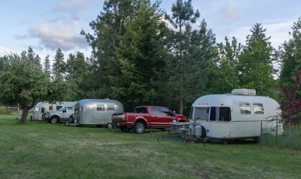
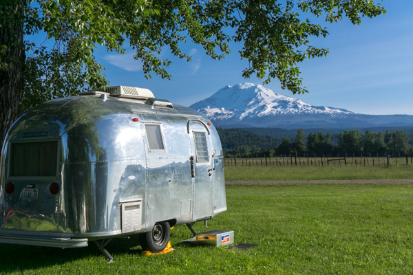
So here we are with a couple of the neighbors for the weekend. The little silver one is mine. I had gotten it all prepared and tested at home, but the one thing I did not notice until I was here and living unplugged, was that my battery was dead! It wouldn’t hold much of a charge for long. So it was ok for the lights, because they are LEDs and don’t need much juice. A little tougher on the waterpump, because it is a power hog, but I can get by just fine without it by keeping a pitcher of water handy The fridge ran fine on propane. But it was pretty cold up there at night, and not having a heater was going to be a bummer. Luckily I had friends who brought over their generators and charged me back up to full every day, which was enough to get the heater running at night long enough to warm the place up, and I had a couple warm blankets too, so it wasn’t bad at all.

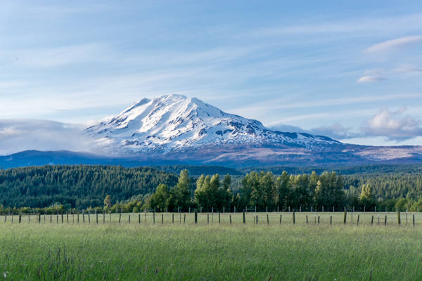
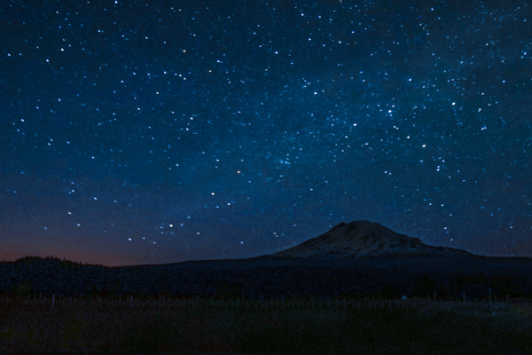
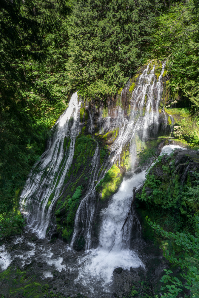
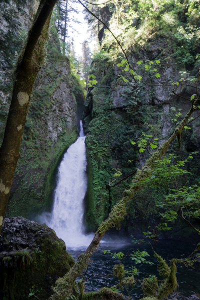
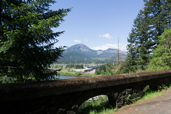
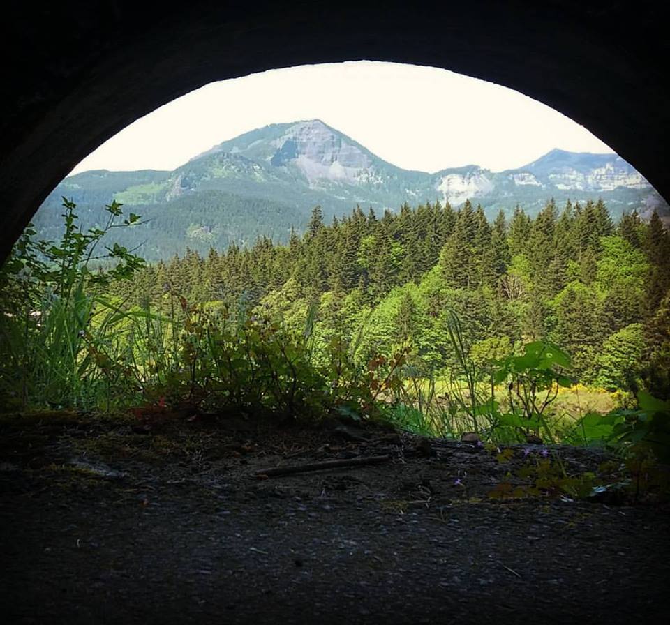
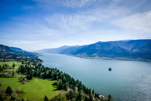
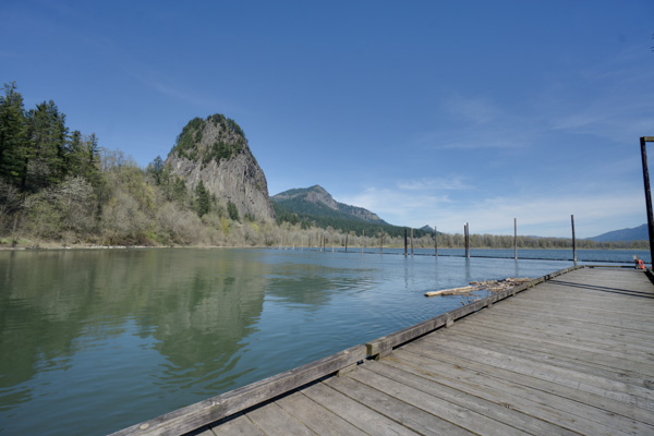
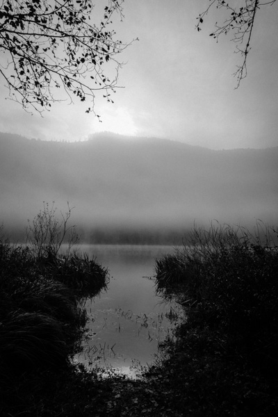
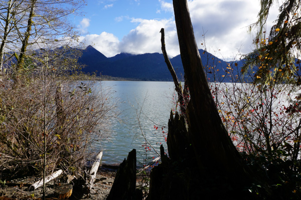
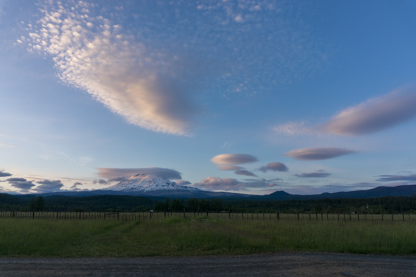
The mountain was jaw-droppingly beautiful, as usual.

And there was this weird cloud that didn’t even look real just hanging out that afternoon.

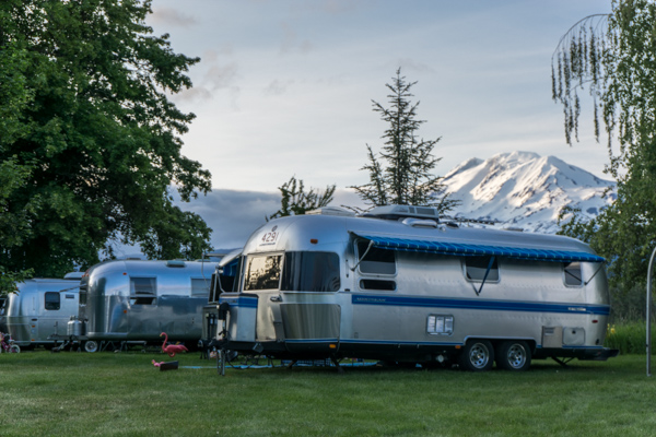
More happy Airstreams

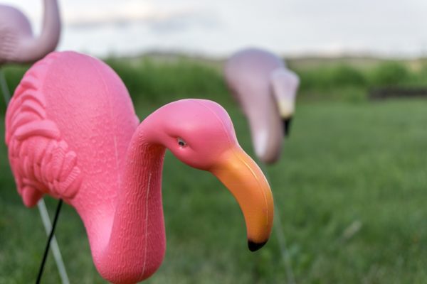
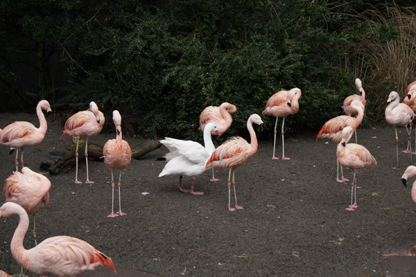
No Airstream gathering is complete without flamingos

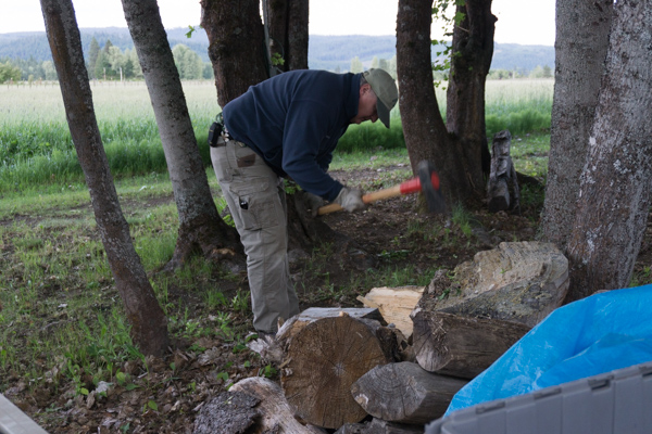
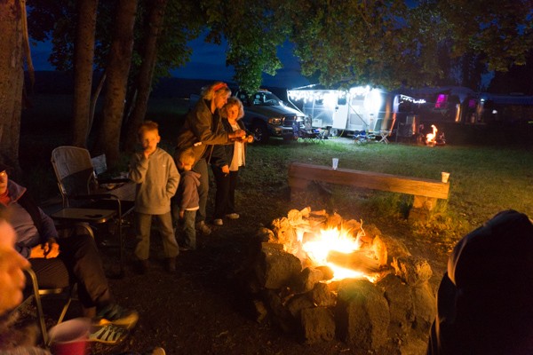
Jonathan was chopping wood…

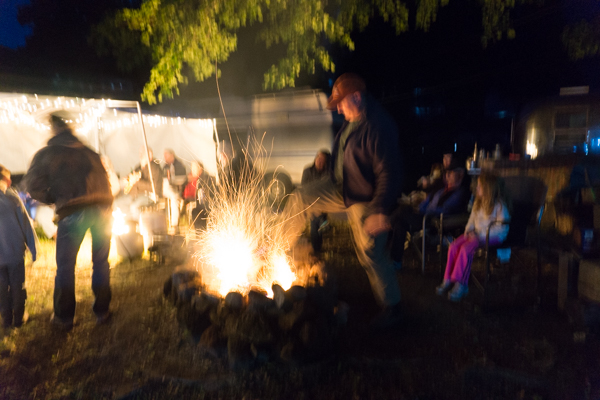
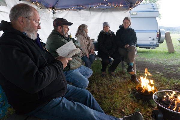
So he could make campfire magic later. He’s a fire wizard!

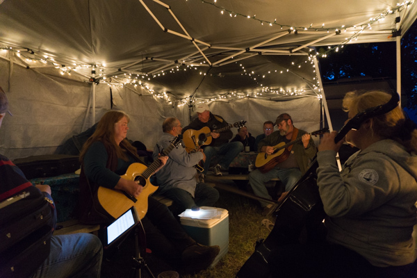
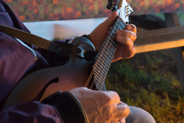
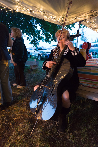
Then the musicians start gathering

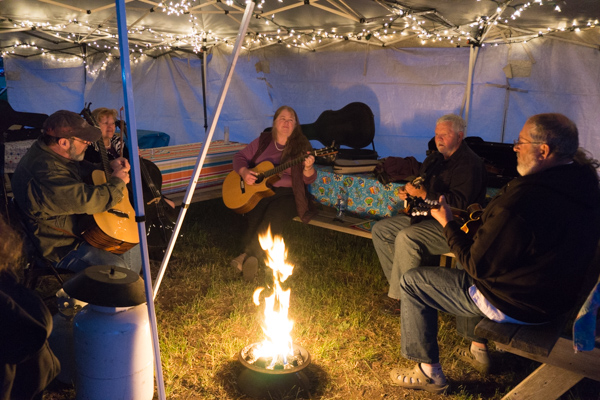
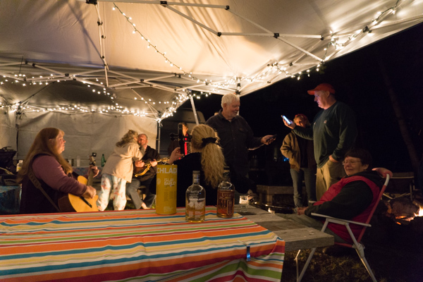
And a fine time was had by all!

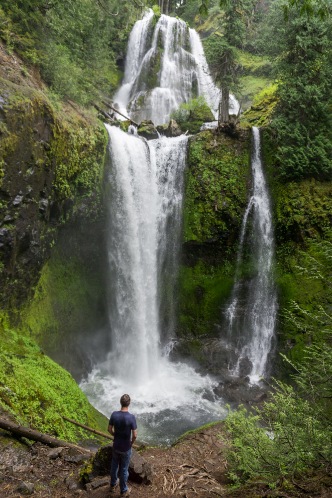
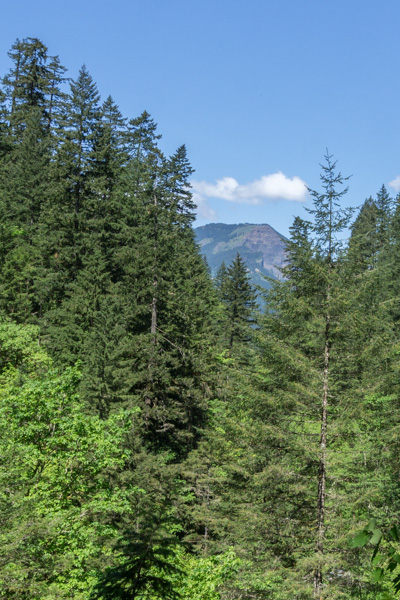
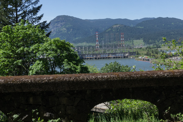
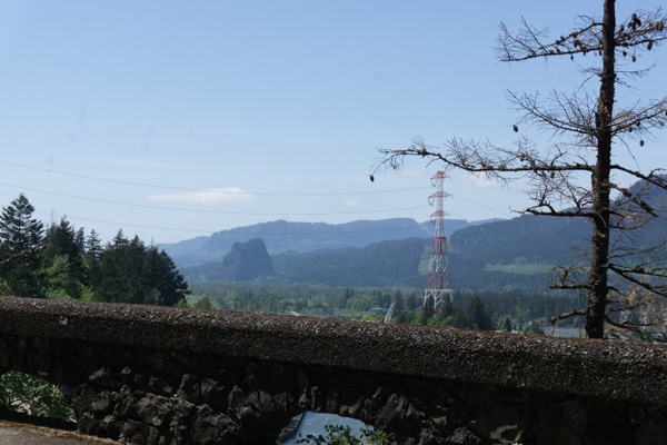
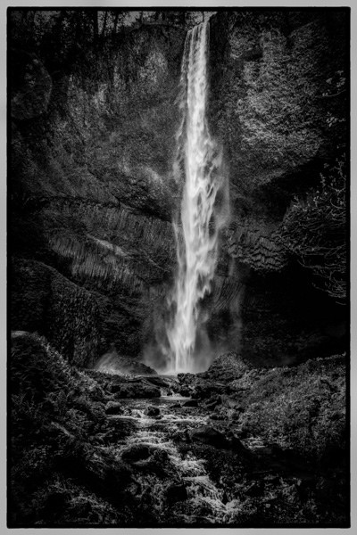
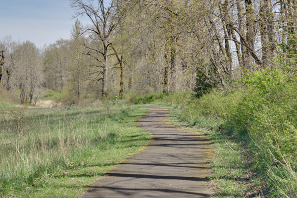
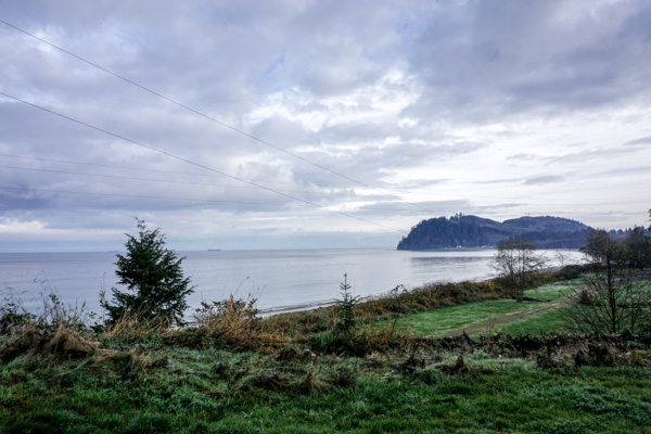
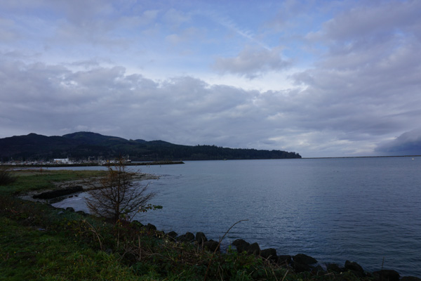
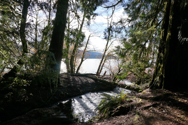
I never get tired of the view.

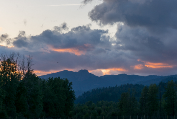
Magical clouds over ‘Sleeping Beauty’

Stars over the mountain at night. So many stars I don’t even know what I’m looking at. That’s Cassiopeia over the mountain. I guess the skyglow is from Seattle? We’re a long way from it, but it’s in that direction.
More music. We never get tired of music.
The electronic devices come in handy when no one can remember the lyrics!
(not my trailer – that’s Gail’s trailer, which is very similar to mine)
The last morning. What a beautiful morning! Dave came back and hooked up our little trailer and we headed home. It was great to see everyone, as always, and we missed our friends who couldn’t make it this year. Trout Lake is always the best kickoff anyone could want to the camping season.
_

Panther Falls and Falls Creek Falls (and Cave)

For my weekly outdoor adventure I decided to drag Dave along. For one thing, I hadn’t forced him out into the woods lately, and I thought it would be good for him. For another thing, it was a LONG drive out to the woods, and I didn’t want to be alone if I broke the Miata.

So we headed down Highway 14 to White Salmon, and headed north into the Gifford Pinchot National Forest. We had a guidebook, ‘Curious Gorge’, but in retrospect next time I’ll bring some accurate maps. This wasn’t like driving the old highway to Multnomah Falls. Forest roads are winding and poorly marked, and I was a bit worried we were going to get lost more than once! And it’s not like someone is going to come along and help you find your way, there’s not a lot of people out there in the middle of the week!

First stop: Panther Creek Falls.

I was told this is the most spectacular waterfall you’ve never heard of. There isn’t even really a trailhead, just a wide spot of rutted dirt to park alongside the road. Then you walk back along the road about 50 ft and there’s an arrow hand-spray painted on the road that says ‘falls’ – we almost missed it. Follow the little path there into the bushes, and suddenly you are walking on a lovely path through tall trees.

The path goes down to follow this stream a short distance, protected by a fence, and then to a viewing platform for this:

 It’s difficult to capture how big this is! It’s two streams flowing down this huge wall of rock.

 The streams that tumble down to the waterfall are pretty impressive on their own.

So that was a very short walk to a very spectacular waterfall. People told me if it wasn’t located deep in the woods, everyone would be flocking to it. I agree!

 Next stop – Falls Creek Cave.

We didn’t do much at Falls Creek Cave except look at it and change our minds about going any further. I think I would do this if I came with more people, but with just the two of us, if someone got hurt, it would be bad. We decided to hold off on this adventure.

Next stop: Falls Creek Falls

So, again, people told me this is the best waterfall in the Gorge (though it’s quite a ways from the Gorge itself. They assured me it was worth it. It’s a two mile hike in through a lovely forest along a river for much of the hike.

One neat feature, again – hard to capture in photos, was this section where you cross over a little stream coming down the hill, and the rocky area the water is coming out of is all covered in beautiful moss. It was really other-worldly.
The trail continued along past this neat rock wall all covered in moss and ferns
Finally we heard the falls, and looking up, way up, we caught sight of it – the upper falls. Seeing photos of it did not prepare me for how HUGE it was, and the spectacular roar of the water, and the rush of wind coming off of it. It was amazing!

Midweek hiking for the win! We had the viewpoint to ourselves.

Lunchtime, with a view!

Dave climbed down to the lower viewpoint to try and give a little more perspective. As he said, it looked like something you’d expect to see in the jungles of Peru or something!

Finally we headed back, and Dave took a picture of me crossing the bridge at the beginning of the trail. It was a great hike, and a spectacular waterfall.

_

Wahclella Falls / Toothrock

Another day, another adventure in the Gorge. I’ve lived here my whole life and never wandered out to these places before, it’s great to finally be exploring them.

Wahclella Falls is at the end of a short 1 mile hike through a canyon surrounded by steep walls. It’s an easy trail, and super popular. I went on a Saturday with one of the photography groups I hang out with.

When I got to the trailhead at 9:30 it was already full. It is a small trailhead. But there was parking on the road, so I parked there and walked back. The clouds were starting to clear and it was looking like a “blue sky – puffy cloud day” was in store.

As we walked along Tanner Creek there were some nice little waterfalls along the way, including Munra Falls, which I’ll grab a pic of on the way back.

But eventually the trail slowly climbed it’s way up until the water was far below.
Walking under cover of the forest.

Finally we broke out of the forest and crossed to the sunny side of the creek.

The walls of the canyon looked like old lava flows, with lots of basalt columns.

There were places where HUGE boulders had fallen down into the river. One of our fellow hikers said it happened back in the early 70’s. These boulders are as big as a house!
Here is a closeup so you can see the guy standing on one of them in the picture above.
Finally we came to Wahclella Falls itself. It comes roaring out of a slot in the wall at the end of the canyon. Above it you can see a sliver of a little waterfall feeding into it.
And when you get to just the right spot in front of it you can see there is another waterfall further up the slot. Imagine how long the water has been flowing there to carve that slot!
Another feature very close to the falls was a place where water runs down off the rocks like a constant rain and trickles over this moss-covered wall. Almost impossible to get a good photo of, the water comes down over it like natural misters, and the moss wall twinkles from all the water running down over it. It’s kind of magical that something like this exists at all.
After crawling all over the Falls area looking for great shots, we retreated back to the sunny side of the creek for lunch. 
I’m getting in the habit of taking pictures of my boots to show where I’ve been.
Finally we headed back, stopping for pictures along the way.

Tiny flowers!
Then we passed Munra Falls again.
It comes down a sloped rock wall, and the trail bridge goes right next to it. Makes it very difficult to photograph!
So that was a fun morning out. Since the hike was only two miles, I had energy for a bit more. When I returned to my car I decided to drive up to the Toothrock Trailhead and see what was there. It is a restored section of the historic highway only open for walkers and bikes. So I took a stroll there. Great views of the river and Bonneville Dam.

Beacon Rock!
I was walking down the trail wanting to see Toothrock. I figured it was something like Beacon Rock. Eventually I realized I was walking alongside it the whole way – it is a HUGE rock. The freeway goes through a tunnel THROUGH it. I walked about a mile before I figured it out. Then I walked back, and stopped for a snack and sat on the old highway rockwork and enjoyed the view of the gorge and the cars zipping down the freeway for a bit. 
It was a beautiful day!
_

Multnomah Falls

Back to the Columbia River Gorge for a little hiking. Today I set out to challenge myself to do the most grueling hike I’ve ever been on – to the top of Multnomah Falls. Approx 1.25 miles up, 700ft elevation gain. It’s just kind of brutal, and it’s for no good reason at all, because basically all you can see from the top is the parking lot. But I had to do it. I’m hiking the Gorge, I might as well get it out of my way and check it off the list early.

Same as last week, I took the old highway for a nice scenic drive through the trees, swung by Crown Point again, and ended up at Multnomah Falls. What I wasn’t expecting was that there would be approximately a gazillion people there, and I would spend 20 minutes driving around looking for a parking spot – on a Monday in April?! I finally got one.

Here’s the traditional shot of the Falls, and the Benson Bridge. Beautiful. Much like Mt Hood, Multnomah Falls is one of those things that is ours. I used to visit it almost every summer with Grandma Lynn when I was little. I haven’t been back here in years. We just pass it on the freeway and go, oh look, there it is. I guess it’s time I paid my respects.

So I head on up to the Benson Bridge, and it is so full of people I have to weave between the selfie-sticks and strollers and people snapping photos just to get past. Too crowded for me. I continue on up the trail. Now, I know how awful this trail is, so I take it slow. Slow and steady. Take my time. Stop to rest when necessary. Then I start seeing signs – Switchback 1 of 11! Really, did you need to tell me that?!

As I continue up these steep switchbacks, I’m singing to myself ‘what doesn’t kill you makes you stronger’ and ‘you got me beggin you for mercy’. By switchback 6 I’m questioning every decision in my life that lead to dragging my out-of-shape butt up this trail.

At least #8 has a view. It will be a nice place for them to find my body.

It was really all I could do to keep going, because it was hard, and I am lazy, and I know the view at the top isn’t really going to be all that, but I kept going, because I said I would. I didn’t want to go home and hang my head only having done 8 of 11 switchbacks. I also didn’t want to come back here and do this again later this summer just to prove I could do it. I had to prove to myself I could do it, TODAY. Eventually I made it to the top of the ridge, and then the trail starts going back downhill – turns out the last few switchbacks were short and on the downhill side, so it wasn’t so bad.

Finally I get to the viewpoint. Yup, there’s the parking lot. Oh, and a 542 foot drop to your certain death. Lets back carefully away from that. There’s a railing and all, but still…

Turn around and right behind you is a little waterfall feeding the pool that goes over the edge. Aww, that’s very pretty!

I walked back up the river and sat by it, photographing the rapids, having a snack and some more water. The people thinned out and it was very peaceful. Now I was feeling pretty good about my determination and perseverance. I guess there’s something to pushing yourself to meet a goal. I really feel proud of myself. I did it! And here’s my reward:

There were some very pretty rapids here. I should carry a little tripod for long exposures like these.

Finally I headed back. I felt nothing but pity for all the folks who were on their way up as I enjoyed the downhill trail. Finally I was back to the Benson Bridge, and it wasn’t as crowded, so now I could stop and enjoy the view of the upper falls.

That’s it, I was right up there…

Wow, that’s way up there!

Back past the Lodge and the fudge and ice cream stands and the smell of waffle cones, I found my wee little car and headed home. It was a good day.

_

Latourell Falls

I headed off for another adventure in the Columbia River Gorge, but this time I went down the Oregon side, headed for Angel’s Rest, which is a short hike to an overlook.

I got off in Corbett, OR, and took the Historic Columbia River Highway. There are lots of great overlooks, like this one at the Portland Women’s Forum Overlook, with a view of Crown Point, and Beacon Rock in the distance.

I enjoyed top-down cruising on this little adventure, thanks to Mr Miata. Here we stopped at Crown Point, Vista House.

Vista House is a classic stopping point on any trip in the Gorge. I can even see it from Steigerwald Wildlife Refuge back home.

So I guess I shouldn’t be surprised I can see Steigerwald from Crown Point! Hey, it’s right down there!

I continued down the old highway, enjoying driving through the tunnel of trees, when I came to Latourell Falls. I stopped to stretch and have a look at the falls which was an easy stroll from the parking lot.

The water was coming down so hard I had a tough time keeping my lens dry!

I had a black & white assignment to do for photo club, so I used one of these shots. I liked the contrast of the water against the rocks, and the texture of the rocks.

I returned to the parking area and pulled out my Curious Gorge Guide, and saw that Latourell has a 2 mile hike up to the upper Latourell Falls, and it rated it as easy to moderate, where Angel’s rest was rated moderate to difficult. Since I’m just getting in shape, I decided this sounded like a better option. I grabbed my pack and headed up the trail.

The trail is pretty, winding through the woods. Lots of little wildflowers here and there. It was shady and cool.

A few more peeks at lower Latourell Falls between the trees.

What a peaceful walk. There were other people on the trail, but not enough to be annoying. In fact I felt safer with a few people around, since I was alone.

I got tired and stopped for a break to drink some water, and laid back on a log and looked up at this amazing tree for a bit. Just think about how old that tree is! Think about the people who preserved this so we could enjoy it! We are so lucky to live in a place where that is a priority and we can afford to do so.

Finally I reached Upper Latourell Falls.

This picture doesn’t do it justice! It was pounding! There was a lot of water coming off of it, a mist reaching me even though I was still quite a ways back. Maybe this video will help:

https://player.vimeo.com/video/164207619 Upper Latourell Falls from Stephanie Roberts on Vimeo.

It’s all downhill from here…

More pretty flowers.

Finally I came to a rest stop with a view of the Columbia River and a nice bench for sittin’ and thinkin’.

Continuing down the trail, I came to this crazy tree!

And I saw a snail, which I guess isn’t too exciting, except we just don’t really have snails in the Portland area, I have hardly ever seen snails just hanging around. We got SLUGS, oh boy do we ever, but not snails.

Thank you, Mr Talbot!

Then the trail went back to the Historic Highway, and it was a short walk back to the parking area.

This was a really nice, easy hike, and the waterfall was totally worth it. I’m so glad I stopped to check it out!

_

Beacon Rock State Park

I spent a lovely afternoon at Beacon Rock State Park, right up the road in the Columbia River Gorge.

I have not spent much time up there. I did a little scouting trip a few weeks ago to check it out, and went back to spend more time photographing and doing a little filming, which I turned into this little video:

https://player.vimeo.com/video/161268176 Beacon Rock State Park from Stephanie Roberts on Vimeo.

On the way down I stopped at Cape Horn for a look at the Gorge, and Phoca Rock, out in the middle of the river. Down the left bank you can see Beacon Rock in the distance.

Someone planted a flag on the top of Phoca Rock. Apparently it’s been claimed for another nation now 🙂

I got to Beacon Rock and went for a nice stroll around the big meadow. I’m getting in shape this summer, so it was challenging for me. I was pretty tired by the end of it, and I was lugging a tripod and camera gear.

Saw this guy along the way, just sunning himself on the path.

From across the meadow I took a zoomed in photo of Beacon Rock, and by zooming way in on that I could see the path to the top. Apparently it is currently closed because of wind damage from a storm last winter.

After the meadow walk I strolled down to the docks. I want to come back and get a reflection of the rock in the water some morning. A friend took a picture like that and I was really impressed.

Cool rock formations on the Rock.

This was a very relaxing afternoon. I could not have asked for any better.

_

Explore Washington Vacation – Day 4 – The Penninsula

I think the only thing I don’t have a picture of from our trip is the actual Olympics! Because of the weather we ended up sort of skirting around the edge of the park, and the clouds only parted to give us a peek at the peaks a couple times.

We headed out from Forks that morning heading for Port Angeles. As we drove along through more boring forestry lands without any sort of view, I saw signs for Neah Bay – the westernmost tip of WA state. I hadn’t planned on the side trip, but we discussed it and decided what the heck, we might not be back out here for a while, we should go see it.

It was this sort of morning:

All along the way we stopped at pull offs to admire the beautiful ..um, I’m not sure what you call this body of water. It’s the water between us and Canada at the pointy end of Washington.

Finally we reached Neah Bay. It is a Native American village. They had a very good museum describing the history and the abuse of the Makah people, and how they almost lost their culture and had to get it back. Very interesting, and very sad.

We continued on to Port Angeles.

This GIANT oil rig was parked offshore. It is the Polar Pioneer, and apparently it’s some sort of drilling rig. It was HUGE!

We had a nice lunch at a little pub, where I got some very good poutine. Then we continued the long drive back to LYH. Along the way we stopped at a wayside for a nap, and saw this sign. We were discussing it when Dave started speculating on what sort of animals were OVER 8ft in length, and therefor didn’t require a leash. I was laughing too hard to correct him! 

We got back to LYH shortly after dark and found the trailer was just fine, as we had left it. Dave snuck off to the casino for one last evening of gambling. I stayed home and read and relaxed, but unfortunately I seem to have picked up a stomach bug from one of the many places we had eaten along the way. By the next morning all I wanted was to go home! So we cancelled the rest of the trip and headed home. We’ll have to save the East side of the state for next time.

And next year I hope we get a chance to come when the weather is nicer, and actually visit the park.

_

Explore Washington Vacation – Day 3 – The Beaches

On Day Three we left the trailer safely parked at LYH and headed for the Washington coast. For MANY years I have wnated to visit Kalaloch after seeing it in a Sunset Magazine, and we were finally getting around to heading there. We had been close, but it is just so far up the coast, we had never quite made the trip.

The trip is actually pretty boring. From Grays Harbor Highway 101 actually goes inland and stays there, so it’s just a long drive through mostly forestry land. We did stop for a quick look at a cool lake mid-morning.

We were also tempted by signs leading us to this ‘biggest tree’. Pretty damned big, indeed.

Finally we got what we were coming for – Kalaloch, and a view of the ocean.

We stopped and had lunch at the fancy lodge, but when we tried to get the price for a room no one could tell us up front how much it was, and suggested we look online, which seemed odd. So we decided to head on up the road and see whatever else there was to see.

Up the road was Beach 4. A long trail led down from the parking lot, to a strange striated pile of rocks you had to climb down to get to the beach. Luckily there was a sign to explain everything!

 We continued on to another ‘biggest tree’. Cedar, I think. It was big, and bits were falling off of it. We spent a bit of time photographing the ‘Mulder’ head there. Here’s Dave holding it at the bottom of the tree. Big tree!

Continuing on, we went to Ruby Beach. We got there a while before sunset, and I wanted to be sure and get some sunset shots, so we parked the car with a view and took a nap. It was worth waiting for!

When the sun was down we finally left, and headed to Forks. It was dark by the time we got there, so here’s a pic the next morning. We found this nice hotel off the main road. It actually had a suite, and for pretty cheap too. And the nice lady at the front desk steered us to a good restaurant in town.

Not bad. It was the first time I think that we took the trailer on vacation and left it somewhere while we went exploring and stayed in a hotel!

One more day…
_

Explore Washington Vacation – Day 2 – Seattle

So our plans for this day were to hit the Seattle Zoo, which we have never been to, and Seattle Center again, and just see how much time we had to burn.

The zoo was awesome! We love visiting zoos, and this one had really nice habitats, in fact sometimes it was hard to see where the boundaries of the habitats were. The animals seemed very relaxed. It rained on us a bit, but it was still a super nice visit.

THIS GUY was completely nuts! His picture is blurry because he could not sit still. He was running around, flying, flapping past us, climbing the walls, sittin on the bench, basically just all over the place. Fun bird to watch! And he was big, like a chicken. Busy bird!

I’m not even sure this owl was part of the Zoo. He was hanging out by some bird feeders watching the little birds that were cleaning up the seeds on the ground.

This guy was the odd man out at the party!

By afternoon we had seen the whole view and headed out in search of pizza. We tried a place that had great Yelp ratings near the zoo, but it was too foo-foo. We drove on into town and parked near the Space Needle, and found a good pizza joint a block or so away. Here is the view from where we parked. This will be more relevant in a moment…

 We stopped to snap a pic of the SN from the same point of view as the picture I took a couple years ago.

We debated quite a bit about going up in it. Number one – it’s really tall! That’s a long ways up! Number two – it was kind of expensive for just an elevator ride and a view.

Hey, I can see our car from up here! The silver Flex right in front of the black wall. And what the heck is on top of that building?

Had someone snap our picture. First time up for me!

We stayed up there watching the sun set and the ferries come and go until it was too cold, then headed back down.

Next tourist destination – ride the MONORAIL! Why? Because it’s a MONORAIL! You don’t need a reason!

Pretty!

Back to the view from in front of the museum. We waited to see the monorail go by and get a shot of that before we called it a night.

_